U.S. Geological Survey Open-File Report 2010–1150
Sea-Floor Geology and Topography Offshore in Eastern Long Island Sound
 |
||
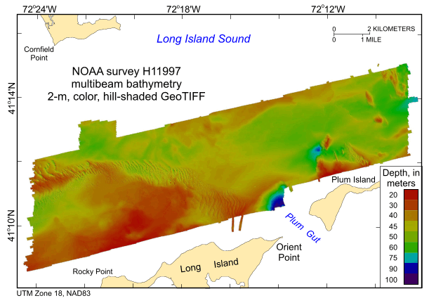
Figure 10. Digital terrain model of the sea floor produced from the multibeam bathymetry collected during National Oceanographic and Atmospheric Administration survey H11997 and gridded to 2 m. Image is sun-illuminated from the north and vertically exaggerated 5X. Hotter colors are shallower areas; cooler colors are deeper areas. See key for depth ranges. | ||


