Skip past header information
USGS - science for a changing world
NOAA Logo with link to NOAA Home Page.CT DEP Logo with link to CT DEP Home Page.  

U.S. Geological Survey Open-File Report 2010–1150

Sea-Floor Geology and Topography Offshore in Eastern Long Island Sound


Skip past contents information

Title | List of Figures | Conversion Factors | Abstract | Introduction | Methods | Bathymetry | Sediment Distribution | Bottom Photography | GIS Data Catalog | Summary | Acknowledgments | References | Contacts


Figure 12. A map of the locations of figures from the report within the study area.

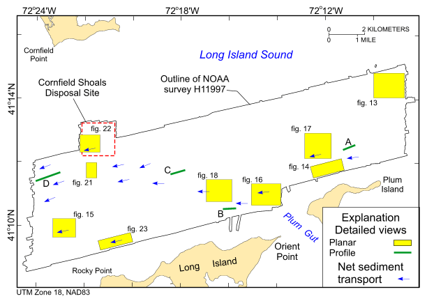
Figure 12. Locations of detailed planar views of the digital terrain model (yellow polygons) and profiles of sand-wave symmetry (green lines). Directions of net sediment transport (blue arrows), interpreted from obstacle marks and bedform asymmetry, and location of the Cornfield Shoals Disposal Site (red dashed line) are also shown. Profiles A-D are shown in figures 19 and 20.

Skip USGS links group

Accessibility FOIA Privacy Policies and Notices

Take Pride in America logo USAGov logo U.S. Department of the Interior | U.S. Geological Survey
End of USGS links group