Skip past header information
USGS - science for a changing world
NOAA Logo with link to NOAA Home Page.CT DEP Logo with link to CT DEP Home Page.  

U.S. Geological Survey Open-File Report 2010–1150

Sea-Floor Geology and Topography Offshore in Eastern Long Island Sound


Skip past contents information

Title | List of Figures | Conversion Factors | Abstract | Introduction | Methods | Bathymetry | Sediment Distribution | Bottom Photography | GIS Data Catalog | Summary | Acknowledgments | References | Contacts


Figure 25. A map of the station locations in the study area.

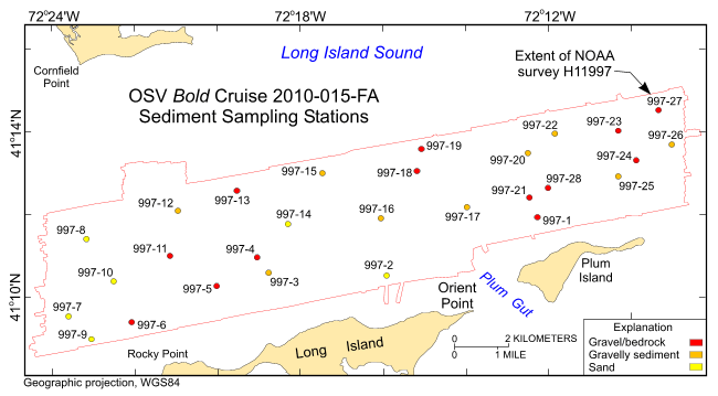
Figure 25. Station locations from U.S. Geological Survey cruise 2010-015-FA used to verify the acoustic data from National Oceanic and Atmospheric Administration survey H11997, color-coded for sediment texture. See key for sediment classifications.

Skip USGS links group

Accessibility FOIA Privacy Policies and Notices

Take Pride in America logo USAGov logo U.S. Department of the Interior | U.S. Geological Survey
End of USGS links group