Open-File Report 2010–1201
ABSTRACT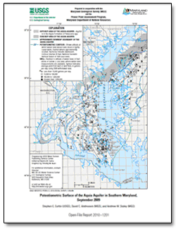
This report presents a map showing the potentiometric surface of the Aquia aquifer in the Aquia Formation of Paleocene age in Southern Maryland during September 2009. The map is based on water-level measurements in 82 wells. The highest measured water level was 48 feet above sea level near the northern boundary and in the outcrop area of the aquifer in the central part of Anne Arundel County. Water levels also were above sea level in Kent County and northern Queen Anne’s County. Water levels were below sea level south and east of these areas and in the remainder of the study area. The hydraulic gradient increased southeastward toward a cone of depression around well fields at Lexington Park and Solomons Island. The lowest measured water level was 145 feet below sea level at the center of a cone of depression at Lexington Park. The map also shows well yield in gallons per day for 2008 at wells or well fields. |
First posted December 2010 For additional information contact: Part or all of this report is presented in Portable Document Format (PDF); the latest version of Adobe Reader or similar software is required to view it. Download the latest version of Adobe Reader, free of charge. |
Curtin, S.E., Andreasen, D.C., and Staley, A.W., 2009, Potentiometric surface of the Aquia aquifer in southern Maryland, September 2009: U.S. Geological Survey Open-File Report 2010–1201, 1 sheet, at https://pubs.usgs.gov/of/2010/1201/.

![]() U.S. Department of the Interior |
U.S. Geological Survey
U.S. Department of the Interior |
U.S. Geological Survey
[an error occurred while processing this directive]
URL: https://pubsdata.usgs.gov
Page Contact Information: Contact USGS
Page Last Modified: Wednesday, 07-Dec-2016 23:00:28 EST
