Skip past header information
USGS - science for a changing world
NOAA Logo with link to NOAA Home Page.Massachusetts CZM Logo with link to MA CZM Home Page.  

U.S. Geological Survey Open-File Report 2011–1004

Sea-Floor Geology and Character of Eastern Rhode Island Sound West of Gay Head, Massachusetts


Skip past contents information

Title | List of Figures | Conversion Factors | Abstract | Introduction | Setting | Methods | Bathymetry | Sediment Distribution | Bottom Photography | GIS Data Catalog | Summary | Acknowledgments | References | Contacts


Figure 33. Two photographs of muddy sand at stations 922-12 and 922-17.

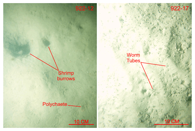
Figure 33. Bottom photographs from stations 922-12 and 922-17 showing a view of the flat to undulating to faintly rippled sea floor composed of muddy sand typical of the deeper parts of the study area. Note the presence of shrimp burrows and worm tubes. Station locations are shown in figures 17 and 28.

Skip USGS links group

Accessibility FOIA Privacy Policies and Notices

Take Pride in America logo USAGov logo U.S. Department of the Interior | U.S. Geological Survey
End of USGS links group