Earthquake Hazards Program
The Colorado River Delta region of southern Imperial Valley, California, and Mexicali Valley, Baja California, is a tectonically dynamic area characterized by numerous active faults and frequent large seismic events. Significant earthquakes that have been accompanied by surface fault rupture and/or soil liquefaction occurred in this region in 1892 (M7.1), 1915 (M6.3; M7.1), 1930 (M5.7), 1940 (M6.9), 1950 (M5.4), 1957 (M5.2), 1968 (6.5), 1979 (6.4), 1980 (M6.1), 1981 (M5.8), and 1987 (M6.2; M6.8). Following this trend, the M7.2 El Mayor-Cucapah earthquake of April 4, 2010, ruptured approximately 120 kilometers along several known faults in Baja California.
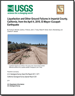
Liquefaction caused by the M7.2 El Mayor-Cucapah earthquake was widespread throughout the southern Imperial Valley but concentrated in the southwest corner of the valley, southwest of the city centers of Calexico and El Centro where ground motions were highest. Although there are few strong motion recordings in the very western part of the area, the recordings that do exist indicate that ground motions were on the order of 0.3 to 0.6g where the majority of liquefaction occurrences were found. More distant liquefaction occurrences, at Fites Road southwest of Brawley and along Rosita Canal northwest of Holtville were triggered where ground motions were about 0.2 g.
Damage to roads was associated mainly with liquefaction of sandy river deposits beneath bridge approach fills, and in some cases liquefaction within the fills. Liquefaction damage to canal and drain levees was not always accompanied by vented sand, but the nature of the damage leads the authors to infer that liquefaction was involved in the majority of observed cases. Liquefaction-related damage to several public facilities - Calexico Waste Water Treatment Plant, Fig Lagoon levee system, and Sunbeam Lake Dam in particular - appears to be extensive. The cost to repair these facilities to prevent future liquefaction damage will likely be prohibitive. As such, it is likely that liquefaction will recur at these facilities during the next large earthquake in this area.
Download the pamphlet as a 94-page PDF file (50.6 MB).
Download the plate as a 42" x 44" PDF file (13.5 MB).
Download the table of detailed sites as spreadsheet files in several formats (2 MB total).
Suggested citation and version history
For additional information:
Contact Information, Earthquake Science Center, Menlo Park Science Center
U.S. Geological Survey
345 Middlefield Road, MS 977
Menlo Park, California 94025
http://earthquake.usgs.gov/
Download a free copy of the current version of Adobe Reader.
| Help | PDF help | Publications main page | Western reports |
| Geology | Earthquake Hazards Program |

![]() U.S. Department of the Interior | U.S. Geological Survey
U.S. Department of the Interior | U.S. Geological Survey
URL: https://pubs.usgs.gov/of/2011/1071/
Page Contact Information: Contact USGS
Page Created: June 30, 2011
Page Last Modified: July 22, 2011
(mfd)