USGS Open-File Report 2011-1172
By Ellen A. Raabe, Robert D'Anjou, Domonique K. Pope, and Lisa L. Robbins
Overview | Study Locations | Seafloor Habitats | Habitat Mosaic | Resources
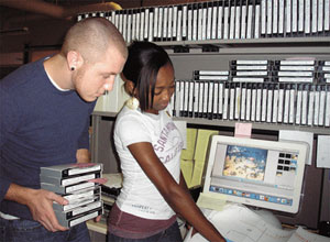
Underwater videos from the Gulfstream Natural Gas Benthic Habitat Survey in 1999 and 2000 (Sea Byte, Inc., 2001) were converted from analog video to digital format at the USGS in St. Petersburg, Florida. The USGS recovered the collection of videos from the Florida Department of Environmental Protection (DEP). Hundreds of hours of analog video tapes were converted to 5-minute digital movie segments and the digital archive was returned to Florida DEP. The archive effort was condensed to this set of sample video clips, maps, and descriptions to demonstrate the range of seafloor types and habitats along the pipeline survey. Maps of video locations and interpretation of video content and seafloor characteristics were prepared by summer interns at the USGS. Available footage was constrained by video quality, depth limits of video collection techniques, and the survey route, and therefore is not an exhaustive inventory of all habitats.
Examples of analog-to-digital video notes can be viewed in the files provided below:
For more information about block diagrams in the Gulf of Mexico, visit: http://www.gomr.boemre.gov/homepg/pubinfo/MapsandSpatialData.html
For more information about the Outer Continental Shelf (OCS) and Offshore Energy and Minerals Management (OEMM), visit: http://www.boemre.gov/offshore/
We thank everyone who played a role in the development of this product. Several people deserve personal recognition for their assistance: Debby Tucker, Florida Department of Environmental Protection, for providing access to the analog video tapes; Whitney Neugebauer, Eckerd College student, for her role in the analog-to-digital conversion process; Ed (Herbert) Watkins, Williams Co., for tips on the engineering code used to geo-locate the videos; reviewers, Randy Runnels, Preserve Manager of the Tampa Bay Aquatic Preserves, and Chris Moses and Barbara Lidz with the U.S. Geological Survey in St. Petersburg, Florida; and Jolene Gittens, U.S. Geological Survey, for assistance with layout and HTML script.
Click here to see Metadata file.
Vector (ESRI shapefile) files for the select video-clip locations in North Florida State Plane and West Florida State Plane (NAD83) are provided as part of this product:
Any use of trade, product, or firm names is for descriptive purposes only and does not imply endorsement by the U.S. Government. Although this report is in the public domain, permission must be secured from the individual copyright owners to reproduce any copyrighted material contained within this report.

![]() U.S. Department of the Interior |
U.S. Geological Survey
U.S. Department of the Interior |
U.S. Geological Survey
URL: http://pubsdata.usgs.gov/pubs/of/2011/1172/resources.html
Page Contact Information: GS Pubs Web Contact
Page Last Modified: Wednesday, 07-Dec-2016 23:50:41 EST
