U.S. Geological Survey Open-File Report 2013–1060
Sea-floor geology and topography offshore in northeastern Long Island Sound
 |
||
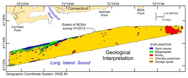
Figure 12. Interpretation of the digital terrain model from National Oceanic and Atmospheric Administration survey H12012. Areas of the sea floor characterized by rocky seabed, sand waves, megaripples, gravelly pavement, and dredge spoils are shown. |
||

![]() U.S. Department of the Interior |
U.S. Geological Survey
U.S. Department of the Interior |
U.S. Geological Survey
URL: http://pubsdata.usgs.gov/pubs/of/2013/1060/html/fig12.html
Page Contact Information: GS Pubs Web Contact
Page Last Modified: Friday, 27-Sep-2013 09:37:37 EDT


