U.S. Geological Survey Open-File Report 2013–1060
Sea-floor geology and topography offshore in northeastern Long Island Sound
 |
||
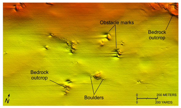
Figure 15. Detailed planar view of the multibeam bathymetric data from National Oceanic and Atmospheric Administration survey H12012 showing relatively small bedrock outcrops on the basin floor south of Hatchett Point. Scour features around the outcrops indicate net westward sediment transport. Location of view is shown in figure 13. |
||

![]() U.S. Department of the Interior |
U.S. Geological Survey
U.S. Department of the Interior |
U.S. Geological Survey
URL: http://pubsdata.usgs.gov/pubs/of/2013/1060/html/fig15.html
Page Contact Information: GS Pubs Web Contact
Page Last Modified: Friday, 27-Sep-2013 09:54:16 EDT


