U.S. Geological Survey Open-File Report 2013–1060
Sea-floor geology and topography offshore in northeastern Long Island Sound
 |
||
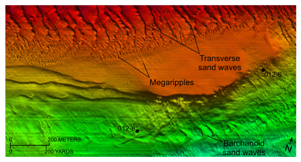
Figure 17. Detailed planar view from the digital terrain model produced from bathymetric data collected during National Oceanic and Atmospheric Administration survey H12012 showing transverse sand waves on top of a shallow shelf platform and locations of stations 012-6 and 012-8. Note that the transition from the bordering relatively flat sea floor is abrupt and that megaripples progressively give way to sand waves. Location of view is shown in figure 13. |
||

![]() U.S. Department of the Interior |
U.S. Geological Survey
U.S. Department of the Interior |
U.S. Geological Survey
URL: http://pubsdata.usgs.gov/pubs/of/2013/1060/html/fig17.html
Page Contact Information: GS Pubs Web Contact
Page Last Modified: Friday, 27-Sep-2013 09:54:16 EDT


