U.S. Geological Survey Open-File Report 2013–1060
Sea-floor geology and topography offshore in northeastern Long Island Sound
 |
||
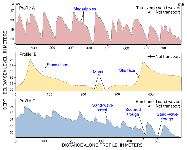
Figure 18. Cross-sectional views of transverse (profiles A and B) and barchanoid (profile C) sand waves from the digital terrain model produced from bathymetric data collected during National Oceanic and Atmospheric Administration survey H12012. Sand-wave asymmetry indicates westward net sediment transport; the presence of megaripples on stoss slopes suggests transport is active. Locations of profiles are shown in figure 13; vertical exaggerations of profiles A, B, and C are 54, 9, and 22, respectively. |
||

![]() U.S. Department of the Interior |
U.S. Geological Survey
U.S. Department of the Interior |
U.S. Geological Survey
URL: http://pubsdata.usgs.gov/pubs/of/2013/1060/html/fig18.html
Page Contact Information: GS Pubs Web Contact
Page Last Modified: Friday, 27-Sep-2013 09:54:16 EDT


