U.S. Geological Survey Open-File Report 2013–1060
Sea-floor geology and topography offshore in northeastern Long Island Sound
 |
||
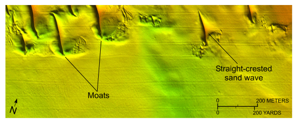
Figure 19. Detailed planar view of relatively straight-crested, non-bifurcating transverse sand waves from the digital terrain model produced from bathymetric data collected during National Oceanic and Atmospheric Administration survey H12012. Note the presence of scour depressions or moats at the ends of the sand waves. Location of view is shown in figure 13. |
||

![]() U.S. Department of the Interior |
U.S. Geological Survey
U.S. Department of the Interior |
U.S. Geological Survey
URL: http://pubsdata.usgs.gov/pubs/of/2013/1060/html/fig19.html
Page Contact Information: GS Pubs Web Contact
Page Last Modified: Friday, 27-Sep-2013 09:54:16 EDT


