U.S. Geological Survey Open-File Report 2013–1060
Sea-floor geology and topography offshore in northeastern Long Island Sound
 |
||
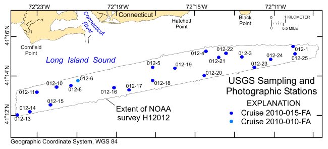
Figure 7. Locations of stations at which bottom samples and photographs were taken during U.S. Geological Survey cruises 2010-015-FA of Ocean Survey Vessel Bold and 2010-010-FA of Research Vessel Rafael to verify bathymetric and backscatter data. |
||

![]() U.S. Department of the Interior |
U.S. Geological Survey
U.S. Department of the Interior |
U.S. Geological Survey
URL: http://pubsdata.usgs.gov/pubs/of/2013/1060/html/fig7.html
Page Contact Information: GS Pubs Web Contact
Page Last Modified: Friday, 27-Sep-2013 09:37:37 EDT


