Skip Links

USGS - science for a changing world

Open-File Report 2013-1306

Geologic Map of Oldonyo Lengai (Oldoinyo Lengai) Volcano and Surroundings, Arusha Region, United Republic of Tanzania

By David R. Sherrod, Masota M. Magigita, and Shimba Kwelwa

Thumbnail of and link to report PDF (3.4 MB)Introduction

The geology of Oldonyo Lengai volcano and the southernmost Lake Natron basin, Tanzania, is presented on this geologic map at scale 1:50,000. The map sheet can be downloaded in pdf format for online viewing or ready to print (48 inches by 36 inches).

A 65-page explanatory pamphlet describes the geologic history of the area. Its goal is to place the new findings into the framework of previous investigations while highlighting gaps in knowledge. In this way questions are raised and challenges proposed to future workers.

The southernmost Lake Natron basin is located along the East African rift zone in northern Tanzania. Exposed strata provide a history of volcanism, sedimentation, and faulting that spans 2 million years. It is here where Oldonyo Lengai, Tanzania’s most active volcano of the past several thousand years, built its edifice. Six new radiometric ages, by the 40Ar/39Ar method, and 48 new geochemical analyses from Oldonyo Lengai and surrounding volcanic features deepen our understanding of the area.

Those who prefer the convenience and access offered by Geographic Information Systems (GIS) may download an electronic database, suitable for most GIS software applications. The GIS database is in a Transverse Mercator projection, zone 36, New (1960) Arc datum. The database includes layers for hypsography (topography), hydrography, and infrastructure such as roads and trails.

First posted January 9, 2014

For additional information, contact:
Contact CVO, Volcano Science Center,
Cascades Volcano Observatory
U.S. Geological Survey
1300 SE Cardinal Court, Building 10, Suite 100
Vancouver, WA 98683-9589
http://vulcan.wr.usgs.gov/

Part or all of this report is presented in Portable Document Format (PDF). For best results viewing and printing PDF documents, it is recommended that you download the documents to your computer and open them with Adobe Reader. PDF documents opened from your browser may not display or print as intended. Download the latest version of Adobe Reader, free of charge.

Part of this report is presented in Microsoft Excel format (XLSX); the latest version of Excel Viewer is required to view it. Download the latest version of Excel Viewer, free of charge.


Suggested citation:

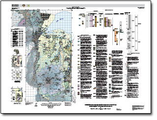
Sherrod, D.R., Magigita, M.M., and Kwelwa, S., 2013, Geologic map of Oldonyo Lengai (Oldoinyo Lengai) and surroundings, Arusha Region, United Republic of Tanzania: U.S. Geological Survey Open-File Report 2013-1306, pamphlet 65 p., scale 1:50,000, http://dx.doi.org/10.3133/ofr20131306.

ISSN 2331-1258 (online)


Accessibility FOIA Privacy Policies and Notices

Take Pride in America logo USA.gov logo U.S. Department of the Interior | U.S. Geological Survey
URL: http://pubsdata.usgs.gov/pubs/of/2013/1306/index.html
Page Contact Information: GS Pubs Web Contact
Page Last Modified: Thursday, 09-Jan-2014 19:44:33 EST