Skip Links

USGS - science for a changing world
DOD Task Force for Business and Stability Operations Logo
Afghanistan Geological Survey Logo

Open-File Report 2014–1119–B

Prepared in cooperation with the Afghan Geological Survey under the auspices of the U.S. Department of Defense

Geologic Map of the Weka Dur Gold Deposit, Badakhshan Province, Afghanistan, Modified from the 1967 Original Map Compilation of M.P. Guguev and Others

By Stephen G. Peters, Will R. Stettner, and Linda M. Masonic

Thumbnail of and link to report PDF (85.8 MB)Abstract

This geologic map of the Weka Dur gold deposit located in Badakhshan Province, Afghanistan, is a redrafted and modified version of the Geological map of the Weka Dur area, scale 1:10,000 and Geological map of the Weka Dur deposit, scale 1:2,000 from Guguev and others (1967) (Soviet report no. R1584). That unpublished Soviet report contains the original maps and cross sections, which were prepared in cooperation with the Ministry of Mines and Industries of the Republic of Afghanistan in 1967 under contract no. 1378 (Technoexport, USSR). This USGS publication not only reproduces the geology of the original Soviet maps and cross sections, but also illustrates a mapped adit with reported gold concentrations from sampling within the adit, and shows the location of Soviet trenches along the Weka Dur gold deposit.

The Weka Dur gold deposit lies in a cluster of other gold deposits in Badakhshan Province (Ragh district), such as the Kadar, Nesheb Dur, and Rishaw gold occurrences. These gold occurrences lie within a zone of late Hercynian folding and are most likely related to fluids that originated from orogenic processes. The Weka Dur deposit is the largest recorded gold occurrence in Afghanistan and is hosted in Proterozoic mica schist and amphibolite that is intruded by diabase dikes and other intrusive rocks. The tabular orebody is 350 meters (m) long and 2 m wide and can be traced downdip for 110 m. Mineralization consists of ochreous, brecciated schists containing high gold concentrations along gently and steeply dipping fissures. The brecciated rocks grade to 46.7 grams per ton (g/t) silver and contain arsenopyrite, galena, chalcopyrite, and scheelite. Trenches and adits were constructed, mapped, and sampled during the 1960s. Calculated resources are 958.3 kilograms of gold, averaging 4.1 g/t gold.

First posted December 16, 2014

For additional information, contact:
Office of International Programs
U.S. Geological Survey
917 National Center
12201 Sunrise Valley Drive
Reston, VA 20192
http://international.usgs.gov/index.htm

Part or all of this report is presented in Portable Document Format (PDF). For best results viewing and printing PDF documents, it is recommended that you download the documents to your computer and open them with Adobe Reader. PDF documents opened from your browser may not display or print as intended. Download the latest version of Adobe Reader, free of charge. More information about viewing, downloading, and printing report files can be found here.


Suggested citation:

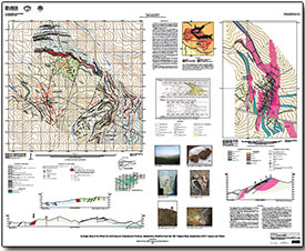
Peters, S.G., Stettner, W.R., and Masonic, L.M., comps., 2014, Geologic map of the Weka Dur gold deposit, Badakhshan Province, Afghanistan, modified from the 1967 original map compilation of M.P. Guguev and others: U.S. Geological Survey Open-File Report 2014–1119–B, 1 sheet, scale 1:10,000 and 1:2,000, https://dx.doi.org/10.3133/ofr20141119B.

ISSN 2331–1258 (online)


Contents

Introduction

References


Accessibility FOIA Privacy Policies and Notices

Take Pride in America logo USA.gov logo U.S. Department of the Interior | U.S. Geological Survey
URL: http://pubsdata.usgs.gov/pubs/of/2014/1119/B/index.html
Page Contact Information: GS Pubs Web Contact
Page Last Modified: Wednesday, 07-Dec-2016 19:41:25 EST