 Introduction
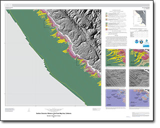
In 2007, the California Ocean Protection Council initiated the California Seafloor Mapping Program (CSMP), designed to create a comprehensive seafloor map of high-resolution bathymetry, marine benthic habitats, and geology within the 3-nautical-mile limit of California’s State Waters. The CSMP approach is to create highly detailed seafloor maps through collection, integration, interpretation, and visualization of swath sonar data, acoustic backscatter, seafloor video, seafloor photography, high-resolution seismic-reflection profiles, and bottom-sediment sampling data. The map products display seafloor morphology and character, identify potential marine benthic habitats, and illustrate both the surficial seafloor geology and shallow (to about 100 m) subsurface geology.
The Offshore of Salt Point map area is located in northern California, about 110 km north of San Francisco and 50 km south of Point Arena. The map area includes three California Marine Protected Areas: the southern portion of the Stewarts Point State Marine Reserve, the Salt Point State Marine Conservation Area, and the Gerstle Cove State Marine Reserve. The coast and shoreline are rugged and scenic, characterized by rocky promontories, steep bluffs capped by bare to forested marine terraces, kelp-rich coves, and nearshore rocks and pinnacles. The largely undeveloped onshore part of the map area is used primarily for grazing and recreation. U.S. Highway 1 extends along the coast through the map area, passing through Salt Point State Park, Kruse Rhododendron State Natural Reserve, and Stillwater Cove Regional Park. Sandy beaches are uncommon, present only in relatively protected coves.
The seafloor in the map area extends from the shoreline to water depths of about 90 to 100 m. The nearshore to inner shelf area (to water depths of about 50 to 60 m) typically dips seaward about 1.0° to 1.5° and is underlain by bedrock and sand-sized to coarser grained sediment. The midshelf, underlain predominantly by muddy sediments, slopes more gently (less than 0.5°). Surficial and shallow sediments were deposited in the last about 21,000 years during the approximately 125-m sea-level rise that followed the last major lowstand associated with the Last Glacial Maximum, at which time the entire Offshore of Salt Point map area was emergent and the shoreline was about 20 km west of the present-day shoreline.
Tectonic influences that impact the shelf morphology and geology in the map area are related to local faulting, folding, uplift, and subsidence. The onshore part of the map area is cut by the northwest-striking San Andreas Fault—the right-lateral transform boundary between the North American and Pacific tectonic plates with an estimated slip rate of about 17 to 25 mm/yr in this area. The region between Fort Ross and Point Arena, west of the San Andreas Fault, is the known as the “Gualala Block” on the basis of its distinctive geology. The Gualala Block consists of a thick, discontinuous Upper Cretaceous to Miocene stratigraphic section, however, only the submarine fan deposits of the Paleocene and Eocene German Rancho Formation are exposed along the coast in the Offshore of Salt Point map area. The German Rancho Formation also forms all of the rugged seafloor bedrock outcrops in the map area. The western boundary of the Gualala Block lies 3 to 5 km offshore, perhaps at the shore-parallel Gualala Fault. High-resolution seismic-reflection data reveal shallow folding and faulting in inferred upper Pleistocene strata along the Gualala Fault trend, suggesting this structure is now or has been recently active. The last ground rupture in the map area occurred during the devastating great 1906 California earthquake (M7.8, 4/18/1906), thought to have nucleated on the San Andreas Fault about 100 kilometers to the south offshore of San Francisco.
Circulation over the continental shelf in the map area is dominated by the southward-flowing California Current, the eastern limb of the North Pacific Gyre. Associated upwelling brings cool, nutrient-rich waters to the surface, resulting in high biological productivity. The current flow generally is southeastward during the spring and summer; however, during the fall and winter, the otherwise persistent northwest winds are sometimes weak or absent, causing the California Current to move farther offshore and the Davidson Current, a weaker, northward-flowing countercurrent, to become active.
Throughout the year, this part of the central California coast is exposed to four wave climate regimes: the north Pacific swell, the southern swell, northwest wind waves, and local wind waves. The north Pacific swell dominates in winter months, with wave heights at offshore buoys ranging from 2 to 10 m and wave periods ranging from 10 to 25 s. During summer months, the largest waves come from the southern swell, generated by storms in the south Pacific and offshore Central America. Characteristically, these swells have smaller wave heights (0.3 to 3 m) and similarly long periods (range 10 to 25 s). Northwest wind waves affect the coast throughout the year, while local wind waves are most common from October to April. These two wind-wave regimes typically have wave heights of 1 to 4 m and short periods (3 to 10 s).
Potential marine benthic habitats in the Offshore of Salt Point map area include unconsolidated continental shelf sediments, mixed continental shelf substrate, and hard continental shelf substrate. Rocky-shelf outcrops and rubble are considered to be promising potential habitats for rockfish and lingcod, both of which are recreationally and commercially important species.
Chapters in the Pamphlet
Chapter 1. Introduction, By Samuel Y. Johnson
Chapter 2. Bathymetry and Backscatter-Intensity Maps of the Offshore of Salt Point Map Area (Sheets 1, 2, and 3), By Peter Dartnell and Rikk G. Kvitek
Chapter 3. Data Integration and Visualization for the Offshore of Salt Point Map Area (Sheet 4), By Peter Dartnell
Chapter 4. Seafloor-Character Map of the Offshore of Salt Point Map Area (Sheet 5), By Mercedes D. Erdey and Guy R. Cochrane
Chapter 5. Ground-Truth Studies for the Offshore of Salt Point Map Area (Sheet 6), By Nadine E. Golden and Guy R. Cochrane
Chapter 6. Potential Marine Benthic Habitats of the Offshore of Salt Point Map Area (Sheet 7), By H. Gary Greene, Charles A. Endris, and Bryan E. Dieter
Chapter 7. Subsurface Geology and Structure of the Offshore of Salt Point Map Area and the Salt Point to Drakes Bay Region (Sheets 8 and 9), By Samuel Y. Johnson, Stephen R. Hartwell, Janet T. Watt, and Ray W. Sliter
Chapter 8. Geologic and Geomorphic Map of the Offshore of Salt Point Map Area (Sheet 10), By Samuel Y. Johnson, Stephen R. Hartwell, and Michael W. Manson
Also of Interest
Open-File Report 2015–1041, California State Waters Map Series—Drakes Bay and Vicinity, California, by Janet T. Watt and others.
Open-File Report 2015–1088, California State Waters Map Series—Offshore of Tomales Point, California, by Samuel Y. Johnson and others.
Open-File Report 2015–1068, California State Waters Map Series—Offshore of San Francisco, California, by Guy R. Cochrane and others.
Open-File Report 2014–1260, California State Waters Map Series—Offshore of Pacifica, California, by Brian D. Edwards and others.

