FIRE and MUD: Eruptions and Lahars of Mount Pinatubo, Philippines
Several fortuitous circumstances led to a wide variety of observations of the 1991 eruptions. Pinatubo gave observers ample advance warning--eruption precursors and, if those were not enough, the publicized drama of evacuations (Punongbayan, Newhall, Bautista, and others) and a series of preclimactic eruptions (Hoblitt, Wolfe, and others). Observers were ready on the ground both east and west of Mount Pinatubo, and, until the climactic eruption, in helicopters as well (west-side story by Sabit and others; east-side story by Hoblitt, Wolfe, and others; summary by Wolfe and Hoblitt). Others made ground-based and satellite-based weather observations. Oswalt and others describe observations by C-band weather radar at Clark Air Base and Cubi Point Naval Air Station, an infrared telescope at Clark, and rawinsondes and pilot balloons for upper level air temperature, humidity, pressure, and wind speed and direction, until nearly the climax of the eruption. Microbarographs at Cubi and Clark and a temperature recorder and rain gage at Cubi recorded throughout the eruption. Geostationary (GMS) and polar-orbiting (AVHRR) satellites captured most of the eruption (Koyaguchi; Lynch and Stephens; Oswalt and others). Tahira and others describe infrasonic and acoustic gravity waves as recorded in Japan, and Zürn and Widmer report very long-period oscillations recorded by a worldwide network of broadband seismographs.
The general chronology of events is given by Wolfe and Hoblitt in the introductory section. The present section includes an interesting observation by Hoblitt, Wolfe, and others that preclimactic eruptions changed from vertically directed explosions (June 12, 13, early 14) to smaller, more frequent, less energetic eruptions with greater components of pyroclastic surge. The authors present a model in which the rate of pressurization of the tip of the magma column is controlled by competing rates of influx of magma, degassing during repose periods, and eruptions themselves.
Plinian fall deposits from the climactic June 15 eruption are relatively thin and inconspicuous (Paladio-Melosantos and others), partly because Typhoon Yunya, which passed near Pinatubo during the eruption, spread ash in all directions over a broad area. Near-source tephra deposits were also scoured by pyroclastic flows, and tephra along the main lobe was blown into the South China Sea. Regrettably, we had almost no information about offshore ash fall while most papers of this collection were being written. Fortunately, sea-bottom samples that were brought to the surface in 1994 (Wiesner and Wang) provide an important, late-breaking constraint on the volume of tephra fall and of the eruption as a whole.
Pumiceous pyroclastic-flow deposits from the climactic eruption--thick valley fill and thin ridge veneers--formed throughout the period of plinian fall, quite unlike models in which pyroclastic flows follow plinian tephra fall. W.E. Scott and others infer either quasicontinuous low-level collapse of portions of a sustained plinian column or repeated collapse of the entire column. Relatively late-stage, lithic-rich pyroclastic flows probably reflect entrainment of old edifice material as the caldera formed.
Significant, as-yet-unresolved discrepancies exist between estimates of column height from weather radar and those from satellites (the latter, 10 km higher during the 0555 eruption of June 15) (see Hoblitt, Wolfe, and others; Lynch and Stephens). Originally, the discrepancy was explained as a result of temperature disequilibrium and adiabatic cooling within the rising eruption column, but the discrepancy remains even if the temperatures are derived from clouds that were some distance away from the eruption column and drifting with similar vectors to that of the ash cloud (Lynch and Stephens). Eruption columns of June 14 and early June 15, as seen from satellites, were different from those seen from the ground. One explanation is that visible and multispectral weather images can show ash in lower concentrations than can weather radar.
Volcanologists routinely correlate deposits with observed eruptions, but most reconstructions of the largest historic and prehistoric eruptions are based on extrapolation of inferences from smaller eruptions. Pinatubo allowed direct correlation of an unusually large and quantified eruption column with features of deposits. Koyaguchi used the rate of expansion of the umbrella cloud, plus grain-size data, to estimate volumetric flow rate of cloud, mass discharge rate, and thence dense-rock-equivalent (DRE) volume of plinian fall deposits. His estimates can be compared to those of Paladio-Melosantos and others as a test of the theoretical approach, or, if one prefers the theoretical approach to sparse field data, his estimates can place upper and lower bounds on the actual volume of tephra. Koyaguchi's estimate for the volume of plinian fall deposit is 2 to 10 km3 DRE, whereas that of Paladio-Melosantos and others is 1.6 to 2.0 km3 DRE. Some of the difference between these two estimates might be explained by W.E. Scott and others' observation that pyroclastic flows (not included in these estimates) were occurring at the same time and could easily have complicated the dynamics of the eruption column.
Also included are two important contributions from far-field, global data. Tahira and others report on-scale, high-resolution infrasonic and acoustic gravity waves in Japan that provide more detail about the intensity of the climactic eruption than was obtained from monitoring near Mount Pinatubo. The infrasonic records show that the strongest phase of the eruption began at 1342, lasted only about 3.5 h, and weakened further after about 10 h. Micro- barograph records of acoustic gravity waves recorded in Japan show oscillations at 4.4 mHz, one of two frequencies of Rayleigh wave oscillation noted by the other contributors of global data, Zürn and Widmer. Apparently, the same atmospheric oscillation that was recorded directly by microbarographs as acoustic gravity waves became coupled to the solid earth and was also recorded as long-period seismic waves.
When the dust finally settled, literally and figuratively, a new caldera was 2.5 km in diameter and more than 650 m deep. Low-resolution digital topography for the preeruption and posteruption periods (Jones and Newhall) shows the new caldera and valley-filling pyroclastic-flow deposits relative to the old summit. Major northeast- and southeast-trending conjugate faults that intersect at Pinatubo, and the origins of the Sacobia, Abacan, and Pasig-Potrero Rivers in a single pyroclastic fan, are clearer in this low-resolution digital topography than in previously published 1:50,000-scale topographic maps.
An important observation in the aftermath of the eruption was that still-fluidized or re-fluidized pyroclastic-flow deposits can move farther downslope as secondary pyroclastic flows (Torres and others). Suspected from previous geologic studies but never before observed, these remobilized pyroclastic flows produce deposits that are nearly indistinguishable from those of the primary pyroclastic flows, except that the former are emplaced at slightly lower temperature and are slightly fines-depleted relative to the parent material.
Beginning in July 1992, another intrusion of basaltic magma into the large dacitic reservoir beneath Pinatubo threatened to replicate events of 1991. Magma mixing and ascent of hybrid andesite occurred as in 1991, but this time they did not trigger a large explosive eruption (Daag, Dolan, and others). The residual dacitic magma was probably depleted in volatiles, but an alternate explanation of the different outcomes was that the 1992 intrusion was too slow or too small to serve as a trigger. As of this writing, Mount Pinatubo remains intermittently restless.
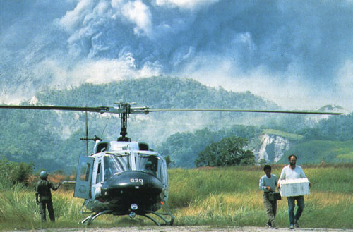
Joey Marcial (PHIVOLCS) and Tom Murray (USGS) attempting restoration of seismic signal from Patal Pinto, June 14, 1991. Helicopter support, USAF: photograph by Val Gempis, USAF.
PHIVOLCS | University of Washington Press | U.S.Geological Survey
This page is <https://pubs.usgs.gov/pinatubo/section5.html>
Contact: Chris Newhall
Last updated 01.21.99