![]()
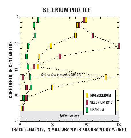 |
| The Se profile rises through a maximum at 10-12 cm, and then declines with increasing depth to levels found in Imperial Valley soils. The maximum might indicate dissolved Se in the Lower Colorado River was about 50 percent higher in 1940 than today. Post depositional diagenesis and historical shifts in redox character of the Salton Sea are other possible explanations for the profile. |
Poster 16 of 16