FISC - St. Petersburg
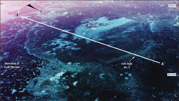
Figure 28. Oblique aerial photo looking southwest shows the large sinkhole off north Key Largo (from Shinn et al., 1996; see Fig. 27 for location). Positions of seismic-reflection profile A-A' (Fig. 29), jet-probe site, and core hole no. 2 drilled into sinkhole rim in 1991 are shown. Light areas are carbonate sand. Dark areas within sinkhole are sea grasses. Dark-crescent area at left side of sinkhole consists of algae. Maximum thickness of sinkhole sediments is not known. Distance across sinkhole is ~600 m.
|
Can't see the printable PDF version? Get the free Adobe Acrobat® Reader. |

![]() U.S. Department of the Interior |
U.S. Geological Survey
U.S. Department of the Interior |
U.S. Geological Survey
URL: [disc] /pubs/pp/2007/1751/professional-paper/tile1/figures/fig28.html
Page Contact Information: Feedback
Page Last Modified: December 01, 2016 @ 04:12 PM (JSS)
