FISC - St. Petersburg
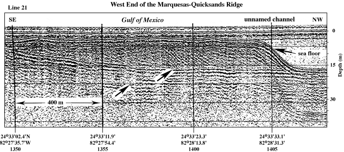
Figure 135. Seismic profile shows 12-m-thick sand accumulation north of Halfmoon Shoal (the more northern of two profile segments in Fig. 129A; from Shinn et al., 1990). Sediment is migrating westward off the Marquesas-Quicksands ridge into deeper water. Left arrow = Pleistocene Q3 Unit of Perkins (1977). Right arrow = top of Pleistocene surface. Latitude and longitude below vertical time lines on profile are given in degrees and decimal minutes based on Loran C TDs (Time Differences). Hours (military time) below coordinates serve as navigational correlation points along seismic line.
|
Can't see the printable PDF version? Get the free Adobe Acrobat® Reader. |

![]() U.S. Department of the Interior |
U.S. Geological Survey
U.S. Department of the Interior |
U.S. Geological Survey
URL: [disc] /pubs/pp/2007/1751/professional-paper/tile11/figures/fig135.html
Page Contact Information: Feedback
Page Last Modified: December 01, 2016 @ 04:13 PM (JSS)
