FISC - St. Petersburg
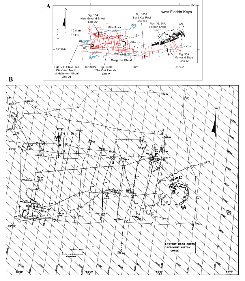
Figure 129. (A) Index map shows tracklines (red) of USGS seismic data acquired in the lower Florida Keys/Gulf of Mexico area and those portions selected (bold black) for illustration with their figure numbers (modified from Lidz et al., 2003). Shelf-margin contour is in blue; contours are in meters. (B) Closeup of seismic tracklines in the Marquesas-Quicksands ridge area (Fig. 130; from Shinn et al., 1990). Bold sections of tracklines indicate areas of pictured seismic data, as shown in (B). Most tick marks on tracklines are at 5-min intervals. Dashed lines indicate travel time without data collection. SOL = start of line. EOL = end of line. V = vibracore site.
|
Can't see the printable PDF version? Get the free Adobe Acrobat® Reader. |

![]() U.S. Department of the Interior |
U.S. Geological Survey
U.S. Department of the Interior |
U.S. Geological Survey
URL: [disc] /pubs/pp/2007/1751/professional-paper/tile9-10/figures/fig129.html
Page Contact Information: Feedback
Page Last Modified: December 01, 2016 @ 04:15 PM (JSS)
