FISC - St. Petersburg
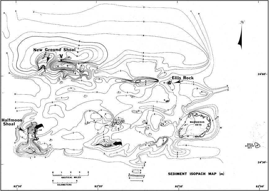
Figure 136. Sediment isopach map of The Quicksands area derived from seismic data (from Shinn et al., 1990). Note general sediment thickness of 1 to 4 m and two areas of thick accretions (bold arrows): 8 m in south-central area and 12 m at Halfmoon Shoal. Sands are migrating westward (as shown on Fig. 135). V = vibracore site.
|
Can't see the printable PDF version? Get the free Adobe Acrobat® Reader. |

![]() U.S. Department of the Interior |
U.S. Geological Survey
U.S. Department of the Interior |
U.S. Geological Survey
URL: [disc] /pubs/pp/2007/1751/professional-paper/tile11/figures/fig136.html
Page Contact Information: Feedback
Page Last Modified: December 01, 2016 @ 04:13 PM (JSS)
