FISC - St. Petersburg
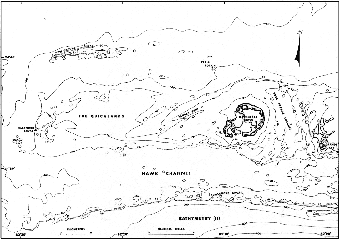
Figure 130. Bathymetry derived from navigation charts in area of The Quicksands, Gulf of Mexico, shows locations of major navigational markers and reefs (from Shinn et al., 1990). The Marquesas-Quicksands ridge is demarcated by the 30-ft depth contour (10-m bedrock contour in Fig. 131 and on Bedrock Surface map). For navigational purposes, bathymetric data should be considered inaccurate in areas of shifting sands.
|
Can't see the printable PDF version? Get the free Adobe Acrobat® Reader. |

![]() U.S. Department of the Interior |
U.S. Geological Survey
U.S. Department of the Interior |
U.S. Geological Survey
URL: [disc] /pubs/pp/2007/1751/professional-paper/tile9-10/figures/fig130.html
Page Contact Information: Feedback
Page Last Modified: December 01, 2016 @ 04:15 PM (JSS)
