FISC - St. Petersburg
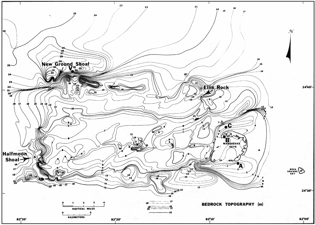
Figure 131. Contour map of bedrock depth (relative to present sea level) shows the Marquesas-Quicksands ridge is elevated above surrounding bedrock surfaces (from Shinn et al., 1990). The ridge is bounded on the north by the Key West Shrimping Grounds, on the east by Boca Grande Channel, on the south by the westward extension of the bedrock depression below Hawk Channel, and on the west by an unnamed bedrock channel (see Bedrock Surface and Benthic Ecosystems maps). A, B, C = rotary rock core sites; V = vibracore site.
|
Can't see the printable PDF version? Get the free Adobe Acrobat® Reader. |

![]() U.S. Department of the Interior |
U.S. Geological Survey
U.S. Department of the Interior |
U.S. Geological Survey
URL: [disc] /pubs/pp/2007/1751/professional-paper/tile9-10/figures/fig131.html
Page Contact Information: Feedback
Page Last Modified: December 01, 2016 @ 04:15 PM (JSS)
