Professional Paper 1386–A
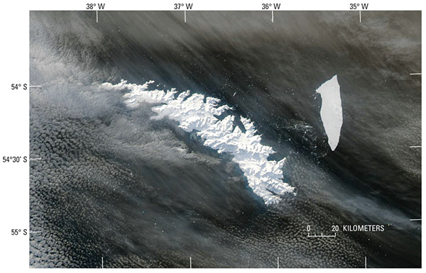
Select image for high resolution and Save to download  Figure 16. MODerate-resolution Imaging Spectroradiometer (MODIS) image of South Georgia Island on 15 July 2004. The island is completely covered with snow, masking the 43 percent of the island not covered with glaciers (see fig. 17). The A-38B tabular iceberg and associated smaller icebergs can be seen east of the island. The “parent” A-38 iceberg (140 km long, 40 km wide; Ferrigno and others, 2005) calved from the Ronne Ice Shelf, East-Antarctica in early October 1998, before breaking into two tabular icebergs (A-38A and A-38B) on 22 October 1998 (Ferrigno and others, 2005). During the 6-year interval between the initial calving event and the date of this MODIS image, the A-38B iceberg has been reduced from its original dimension to about 60 km long, 15 km wide. MODIS image from the Terra satellite of the National Aeronautics and Space Administration. NASA Terra MODIS image at http://veimages.gsfc.nasa.gov/6835/SouthGeorgia.A2004197.1635.250m.jpg. |