Skip Links

USGS - science for a changing world

Professional Paper 1386–A

Chapter A–2 (Figure 17)

Return to Home

Return to figure gallery

Select image for high resolution and Save to download
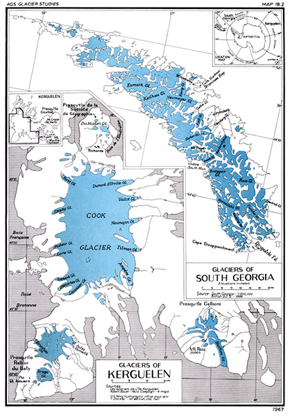
Figure 17.—Maps of the Glaciers of Kerguelen and of the Glaciers of South Georgia showing glaciers on the two subantarctic islands. Map plate from the American Geographical Society Glacier Studies (Mercer (1967, p. 325, Map 18.2©)).Used with permission of the American Geographical Society.

Figure 17. Maps of the Glaciers of Kerguelen and of the Glaciers of South Georgia showing glaciers on the two subantarctic islands. Map plate from the American Geographical Society Glacier Studies (Mercer (1967, p. 325, Map 18.2©)).Used with permission of the American Geographical Society.


Accessibility FOIA Privacy Policies and Notices

Take Pride in America logo USA.gov logo U.S. Department of the Interior | U.S. Geological Survey
URL: http://pubsdata.usgs.gov/pubs/pp/p1386a/gallery2-fig17.html
Page Contact Information: GS Pubs Web Contact
Page Last Modified: Thursday, 01-Dec-2016 16:25:00 EST