Professional Paper 1386–A
Select image for high resolution and Save to download 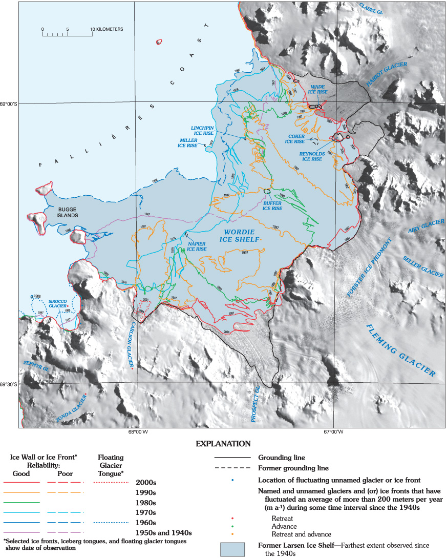 Figure 18. Wordie Ice Shelf map inset, part of “Coastal-change and Glaciological Map of the Larsen Ice Shelf area, Antarctica: 1940–2005.” Selected ice-front positions between 1947 and 2004 are shown, as well as named and unnamed glacial features. See Ferrigno and others (2008) for full map, map explanation, and accompanying pamphlet with tables. Named glacial features and numbered unnamed glacial features are listed in pamphlet and in tables 3 and 4, respectively. Average annual change of the ice front, calculated for the time intervals between years when measurements were made, is detailed in table 5A. |

![]() U.S. Department of the Interior |
U.S. Geological Survey
U.S. Department of the Interior |
U.S. Geological Survey
URL: http://pubsdata.usgs.gov/pubs/pp/p1386a/gallery2-fig18.html
Page Contact Information: GS Pubs Web Contact
Page Last Modified: Thursday, 01-Dec-2016 16:25:00 EST
