Professional Paper 1386–A
Select image for high resolution and Save to download 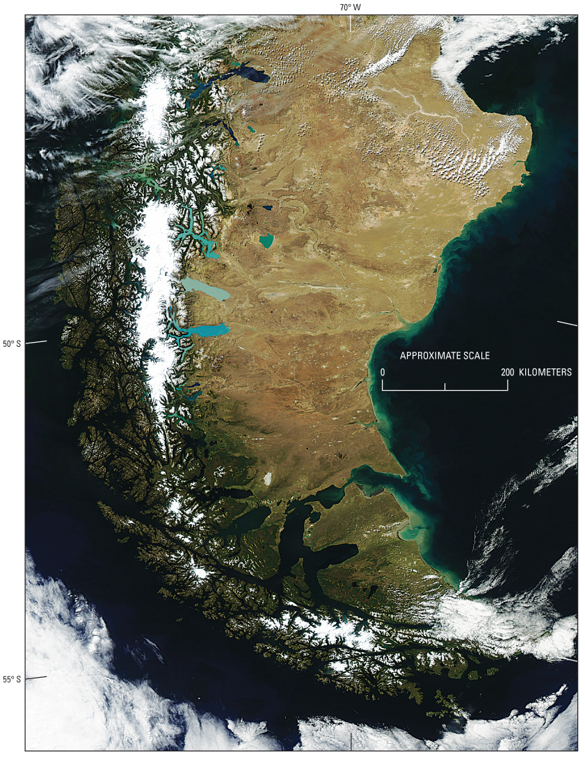 Figure 23. MODerate-resolution Imaging Spectroradiometer (MODIS) image on 2 October 2005 of the Northern Patagonian Ice Field, the Southern Patagonian Ice Field, the ice field of the Cordillera Darwin, outlet glaciers from each ice field, and other glaciers. Some of the glacially scoured “Finger Lakes” (south to north, Lago Argentino, Lago Viedma, and Lago San Martín) in the center of the image are “robin’s-egg-blue color”, the result of glacial rock-flour sediment entering the lakes. MODIS image from the Aqua satellite; Goddard Space Flight Center, National Aeronautics and Space Administration. |

![]() U.S. Department of the Interior |
U.S. Geological Survey
U.S. Department of the Interior |
U.S. Geological Survey
URL: http://pubsdata.usgs.gov/pubs/pp/p1386a/gallery2-fig23.html
Page Contact Information: GS Pubs Web Contact
Page Last Modified: Thursday, 01-Dec-2016 16:25:03 EST
