Professional Paper 1386–A
Select image for high resolution and Save to download 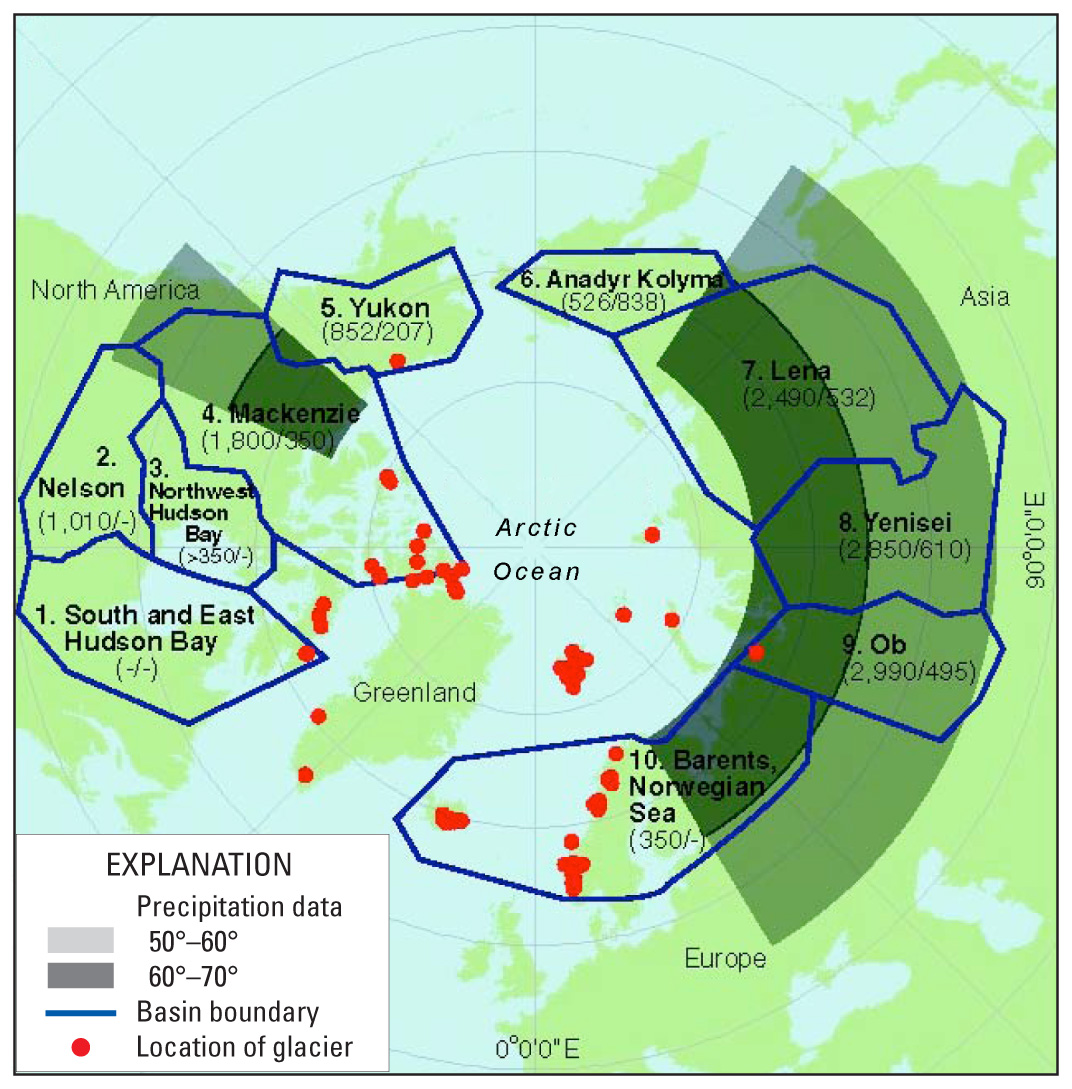 Figure 67. The pan-Arctic drainage area includes the Arctic archipelagoes as well as continental watersheds. The 10 large pan-Arctic river basins (boundaries are shown) with available annual runoff data were used to calculate river runoff to the Arctic Ocean. Red dots show benchmark glaciers with mass-balance records that we used to calculate fresh water runoff from glaciers to the Arctic Ocean. Two precipitation data zones are also shown. Basins are numbered from 1 to 10. First number in each pair of parentheses indicates basin area in thousands of square kilometers; second number indicates discharge in cubic kilometers per year (Lammers and others, 2000). Note that the Yukon River Basin (as defined by Lammers and others (2000)) includes the entire Brooks Range, including the benchmark McCall Glacier (see Chapter K, p. K471–p. K476, and figs. 440 and 441 on p. K474 and p. K475, respectively) and many other river basins that drain to the Arctic Ocean; however, accurate discharge data are not available for basins 1, 2, 3, and 10. Basin 10 does not include calculations of river discharge and glacier meltwater production to reduce the overlap between gauged and ungauged data. |

![]() U.S. Department of the Interior |
U.S. Geological Survey
U.S. Department of the Interior |
U.S. Geological Survey
URL: http://pubsdata.usgs.gov/pubs/pp/p1386a/gallery2-fig67.html
Page Contact Information: GS Pubs Web Contact
Page Last Modified: Thursday, 01-Dec-2016 16:25:26 EST
