Professional Paper 1386–A
Select image for high resolution and Save to download 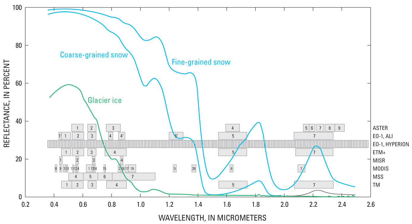 Figure 77. Spectral bands that selected instruments on Earth-orbiting satellites record. The bandwidths of past, present, and experimental instruments are shown against the spectral-reflectance curves of bare glacier ice, coarse-grained snow, and fine-grained snow. The numbers in the gray boxes are band numbers of the electromaganetic spectrum. The Hyperion sensor records 220 bands between 0.4 μm and 2.5 μm; in the diagram the individual bands are not numbered. Instruments are abbreviated as: ASTER, Advanced Spaceborne Thermal Emission and reflection Radiometer; ALI, Advanced Land Imager; ETM+, Enhanced Thematic Mapper Plus (Landsat 7); MISR, Multiangle Imaging SpectroRadiometer; MODIS, MODerate-resolution Imaging Spectroradiometer (36 bands, of which 19 are relevant to discrimination of snow and ice); MSS, MultiSpectral Scanner (Landsats 1–3); and TM, Thematic Mapper (Landsats 4 and 5). Several of these instruments also have bands in the thermal infrared. Landsat bands 1 through 3 generally saturate over snow (Ferrigno and Williams, 1983), but ASTER bands, with their adjustable gains, were designed to avoid the saturation problem (Raup and others, 2007). |

![]() U.S. Department of the Interior |
U.S. Geological Survey
U.S. Department of the Interior |
U.S. Geological Survey
URL: http://pubsdata.usgs.gov/pubs/pp/p1386a/gallery2-fig77.html
Page Contact Information: GS Pubs Web Contact
Page Last Modified: Thursday, 01-Dec-2016 16:25:30 EST
