Select image for high resolution and Save to download

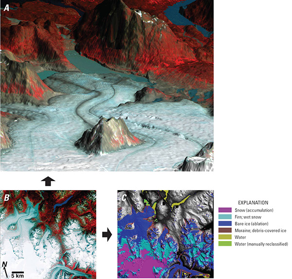
Figure 78. A, Advanced Spaceborne Thermal Emission and reflection Radiometer (ASTER) image (false color infrared composite) draped over an ASTER digital elevation model (DEM) showing the terminus of Llewellyn Glacier, northwestern British Columbia, and proglacial lake; perspective view looking to the northeast. B, Part of an ASTER scene showing Llewellyn (top left) and Tulsequah (lower right) Glaciers. C, Map showing water and glacier features and created from partial ASTER scene shown in B using an enhanced maximum likelihood supervised classification of three derived bands (after Sidjak and Wheate, 1999). The ASTER DEM is the shaded relief base image. Areas of no visible relief are null areas. Image and caption courtesy of Rick Wessels, U.S. Geological Survey, Alaska Volcano Observatory, Anchorage, Alaska. ASTER image (ID SC:AST_L1A.003:2003795732, bands 3, 2, 1 (RGB), acquired on 8 August 2001). From U.S. Geological Survey, EROS Data Center, Sioux Falls, S. Dak. |