Professional Paper 1386–A
Select image for high resolution and Save to download 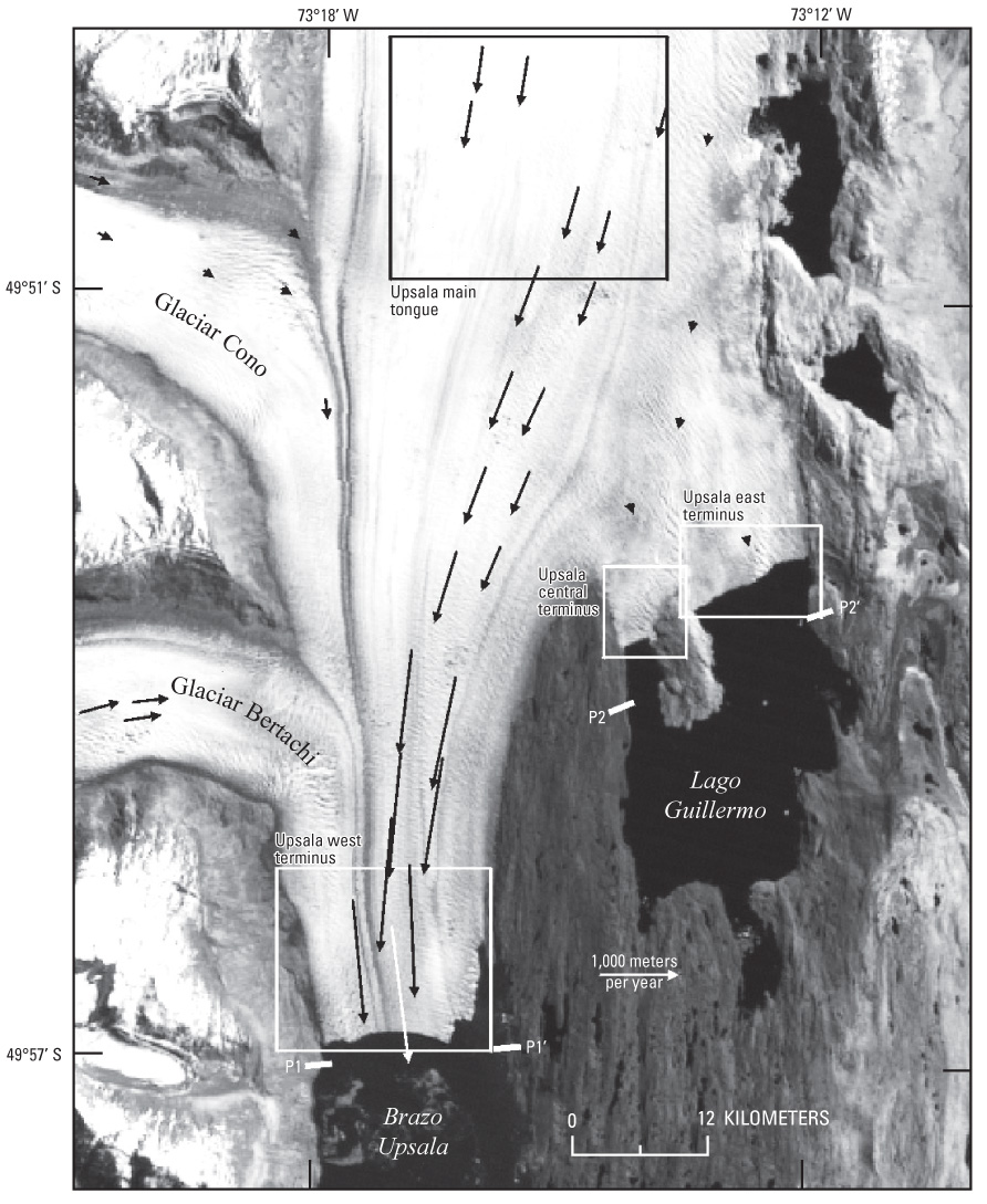 Figure 79. Annotated section of Landsat 7 Enhanced Thematic Mapper (ETM+) image (band 8), acquired on 14 October 2001, showing Glaciar Upsala, Southern Patagonian Ice Field, Argentina, with overlay of representative velocity vectors. The vectors were determined automatically using the IMCORR IMage CORRelation software (Scambos and others, 1992) and were simplified for this figure. P1-P1ʹ and P2-P2ʹ indicate position of depth profiles in Brazo Upsala (arm of Lago Argentino) and Lago Guillermo, respectively. Rectangles indicate areas of velocity analysis, and are given in Skvarca and others (2003). Modified from Skvarca and others (2003, p. 185, fig. 1). |

![]() U.S. Department of the Interior |
U.S. Geological Survey
U.S. Department of the Interior |
U.S. Geological Survey
URL: http://pubsdata.usgs.gov/pubs/pp/p1386a/gallery2-fig79.html
Page Contact Information: GS Pubs Web Contact
Page Last Modified: Thursday, 01-Dec-2016 16:25:31 EST
