Professional Paper 1386–A
Select image for high resolution and Save to download 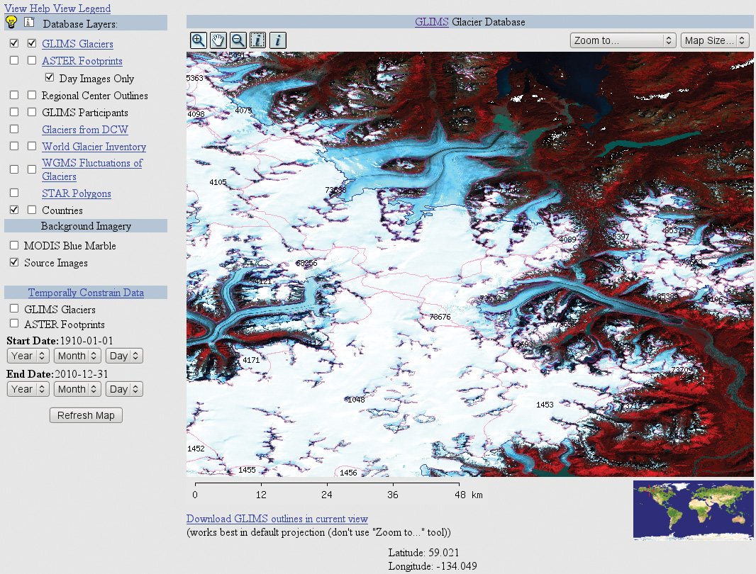 Figure 82. Computer screen display of the GLIMS MapServer showing database layers and options for temporarily constraining data. Elements in image include glacier boundaries (red), boundaries (purple) of internal rock (nunataks), transient snow lines (blue), and glacier analysis IDs (numbers). The Llewellyn Glacier is in the upper center of the image; it is an outlet glacier from the Canadian side of the Juneau Icefield. (See also fig. 78; and Chapter K of “Satellite Image Atlas of Glaciers of the World,” p. K104, fig. 85.) |

![]() U.S. Department of the Interior |
U.S. Geological Survey
U.S. Department of the Interior |
U.S. Geological Survey
URL: http://pubsdata.usgs.gov/pubs/pp/p1386a/gallery2-fig82.html
Page Contact Information: GS Pubs Web Contact
Page Last Modified: Thursday, 01-Dec-2016 16:25:33 EST
