Professional Paper 1386–A
Select image for high resolution and Save to download 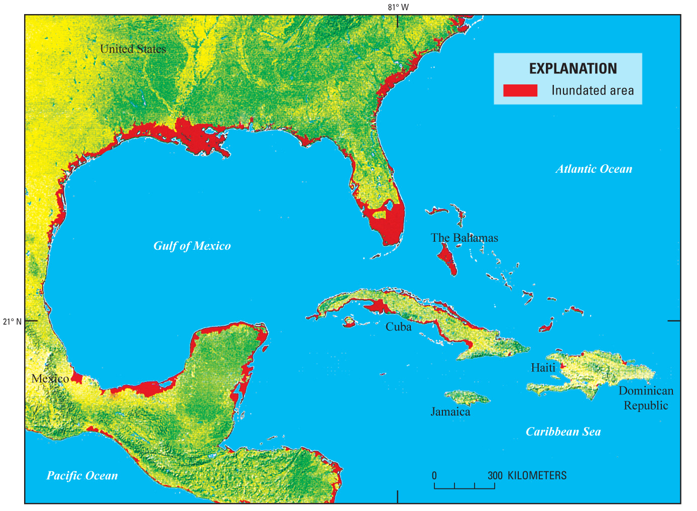 Figure 84. Inundation of low-lying coastal regions and islands in the Gulf of Mexico, Caribbean Sea, Pacific Ocean, and Atlantic Ocean projected as occurring if sea level rises 6 m. Note especially the loss of land in the southeastern United States, Florida, the Louisiana delta, and other areas of the Gulf Coast of the United States and México, especially the inundation of most of the Bahamian islands, which will force its citizens to migrate. Inhabitants of all areas marked in red would be displaced inland. During the last interglacial, most of the Greenland ice sheet melted (Koerner, 1989). The resulting rise in sea level was about 6 m. From Rowley and others (2007, p. 105, fig. 1). |

![]() U.S. Department of the Interior |
U.S. Geological Survey
U.S. Department of the Interior |
U.S. Geological Survey
URL: http://pubsdata.usgs.gov/pubs/pp/p1386a/gallery2-fig84.html
Page Contact Information: GS Pubs Web Contact
Page Last Modified: Thursday, 01-Dec-2016 16:25:34 EST
