Select image for high resolution and Save to download

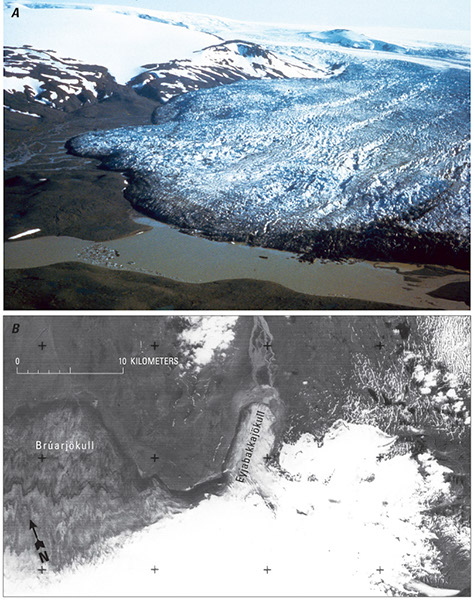
Figure 85. A, Oblique aerial photograph looking south across the terminus of the surge-type glacier, Eyjabakkajökull, as it appeared on 25 July 1973 after it had completed a 2.8-km surge. Photograph by Richard S. Williams, Jr., U.S. Geological Survey. B, Part of Landsat image 30157-11565-D, acquired on 9 August 1978, of Eyjabakkajökull, after the melting and retreat of the glacier’s terminus more than 5 years after its surge. The fractured ice in its lower part, including stagnation during that interval, shows the kind of detail that Landsat 3 return-beam vidicon (RBV) images offer (Williams, 1986a, p. 8, fig. 3). |