Professional Paper 1386–A
Select image for high resolution and Save to download 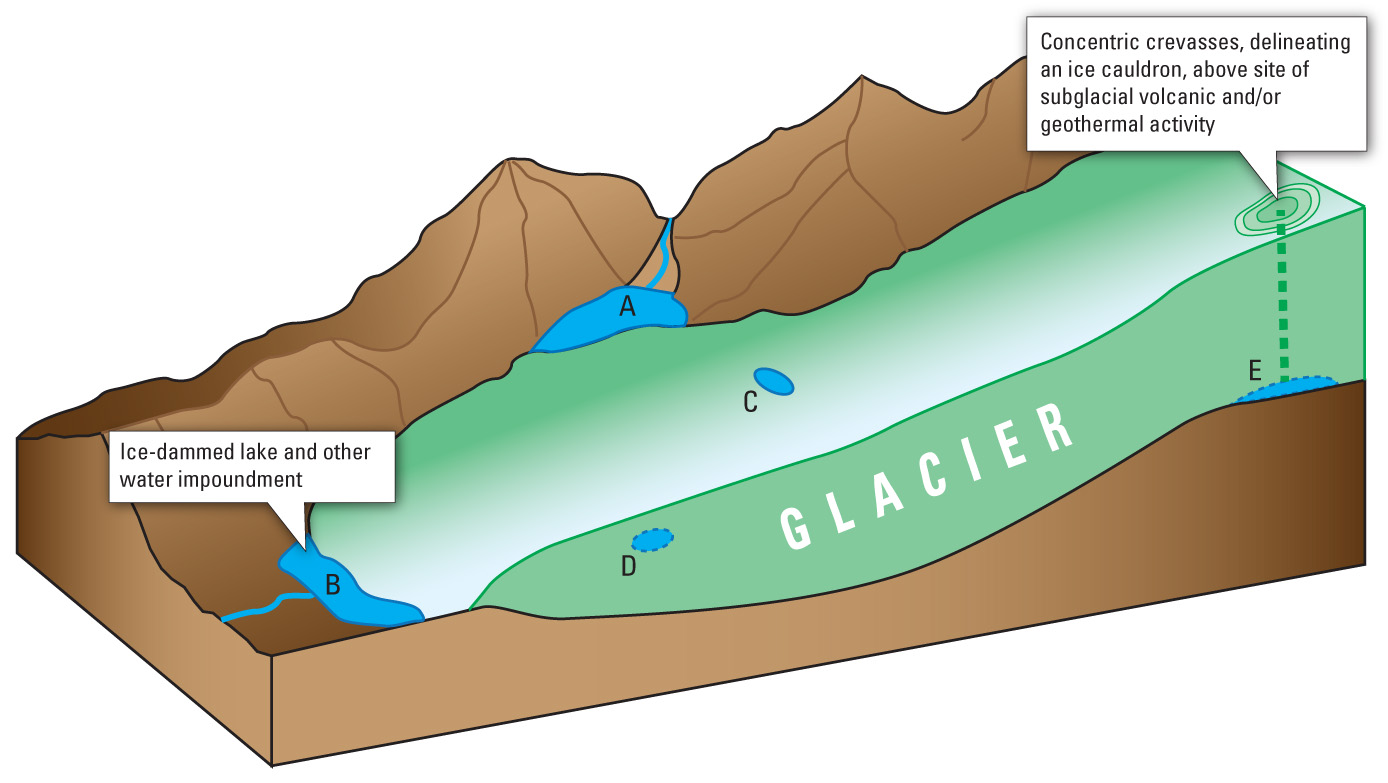 Figure 86. Diagram showing the location of impounded water on, within, under, and adjacent to a glacier; the sudden release of water from such impoundments produces a jökulhlaup. A, Ice-margin lake caused by damming of a tributary valley or distributary glacier from the main trunk of a valley or outlet glacier; B, Proglacial lake at the terminus of a valley glacier or outlet glacier from an ice cap or ice field. C, Supraglacial lake (see fig. 87). D, Englacial lake. E, Subglacial lake. Modified from figure in Roberts (2005, p. 3 of 21, fig. 1). |

![]() U.S. Department of the Interior |
U.S. Geological Survey
U.S. Department of the Interior |
U.S. Geological Survey
URL: http://pubsdata.usgs.gov/pubs/pp/p1386a/gallery2-fig86.html
Page Contact Information: GS Pubs Web Contact
Page Last Modified: Thursday, 01-Dec-2016 16:25:35 EST
