Professional Paper 1386–A
Select image for high resolution and Save to download 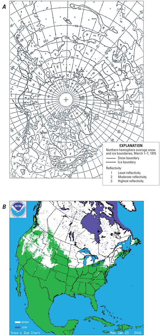 Figure 4.—A, National Oceanic and Atmospheric Administration National Environmental Satellite, Data, and Information Service (NOAA NESDIS) snow map. 1–7 March 1976; B, NOAA NESDIS Interactive Multisensor Snow and Ice Mapping System (IMS) snow map, 23 January 2006. Snow cover is shown in white; sea and lake ice is shown in dark blue. |

![]() U.S. Department of the Interior |
U.S. Geological Survey
U.S. Department of the Interior |
U.S. Geological Survey
URL: http://pubsdata.usgs.gov/pubs/pp/p1386a/gallery3-fig04.html
Page Contact Information: GS Pubs Web Contact
Page Last Modified: Thursday, 01-Dec-2016 16:25:37 EST
