Professional Paper 1386–A
Select image for high resolution and Save to download 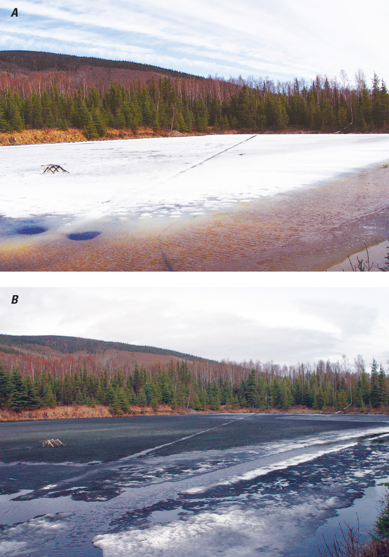 Figure 16 Ice break-up at 33.5 Mile Pond, Steese Highway, Alaska, showing A, the high albedo of snow ice (white ice) on 1 May 2004, and B, the low albedo of the underlying S2 congelation (black ice) on 7 May 2004, after the snow ice had melted completely. Note the low albedo of the water in the moat that accelerates ice decay around the margins. Photographs by Martin O. Jeffries, Geophysical Institute, University of Alaska Fairbanks. |

![]() U.S. Department of the Interior |
U.S. Geological Survey
U.S. Department of the Interior |
U.S. Geological Survey
URL: http://pubsdata.usgs.gov/pubs/pp/p1386a/gallery4-fig16.html
Page Contact Information: GS Pubs Web Contact
Page Last Modified: Thursday, 01-Dec-2016 16:25:49 EST
