Professional Paper 1386–A
Select image for high resolution and Save to download 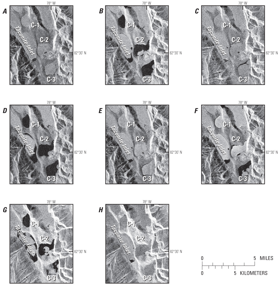 Figure 24. RADARSAT-1 Standard Beam synthetic aperture radar (SAR) images show fracturing, shrinkage, and complete melting of the once-perennial ice on meromictic Lakes C-1 and C-2 and the perennial epishelf lake ice in Taconite Inlet (lat 82.85°N., long 78.22° W.), Ellesmere Island, Nunavut, Canada. Lake C-3 is a well-mixed, freshwater lake. A, 5 September 1997; B, 26 August 1998; C, 8 September 1999; D, 14 August 2000; E, 22 August 2001; F, 21 August 2002; G, 25 August 2003; and H, 19 August 2004. Each image covers an area of 7 km by 8.5 km on the ground. |

![]() U.S. Department of the Interior |
U.S. Geological Survey
U.S. Department of the Interior |
U.S. Geological Survey
URL: http://pubsdata.usgs.gov/pubs/pp/p1386a/gallery4-fig24.html
Page Contact Information: GS Pubs Web Contact
Page Last Modified: Thursday, 01-Dec-2016 16:25:54 EST
