Professional Paper 1386–A
Select image for high resolution and Save to download 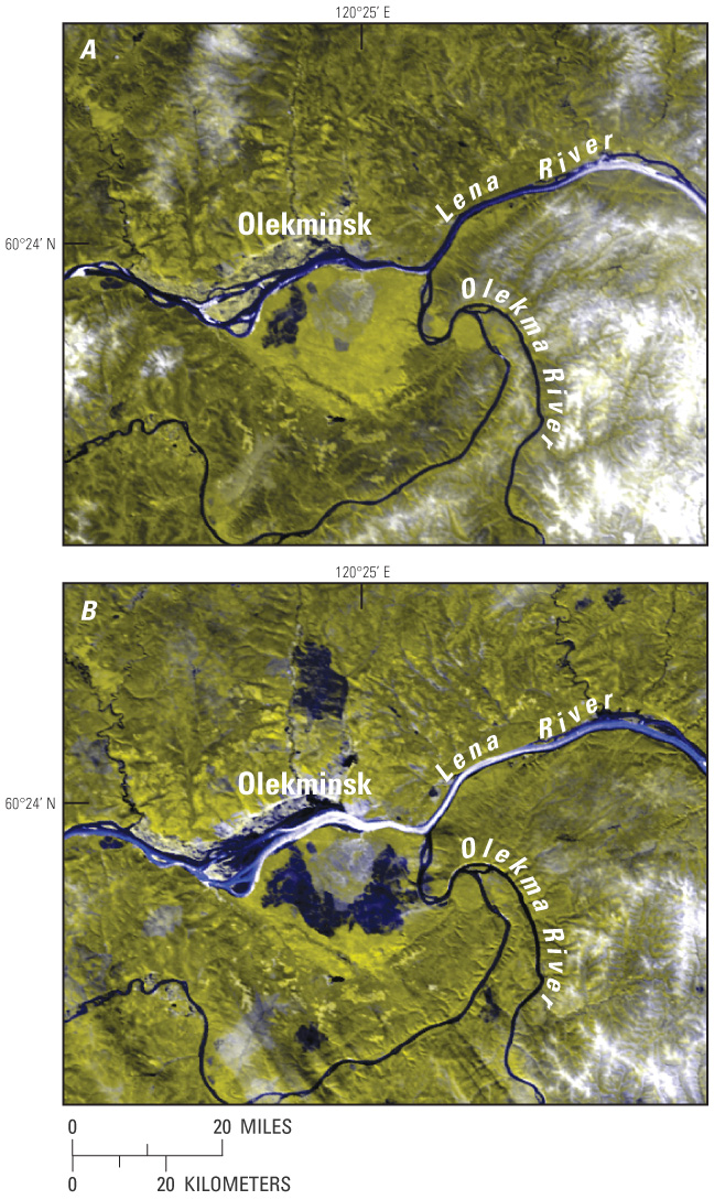 Figure 25. Earth Observing System (EOS) MODerate resolution Imaging Spectrometer (MODIS) (bands 1 and 2) images of the confluence of the Lena and Olekma Rivers, Russia, during break-up in spring 2000 show, A, widespread open water in both channels, except for some ice in the Lena River upstream from the confluence on 12 May, and B, an ice jam and extensive ice in the Lena River up- and downstream from the confluence causing widespread flooding on 15 May. The city of Olekminsk is located at lat 60.4°N., long 120.4°E. Each image covers an area of 105 km by 130 km on the ground. |

![]() U.S. Department of the Interior |
U.S. Geological Survey
U.S. Department of the Interior |
U.S. Geological Survey
URL: http://pubsdata.usgs.gov/pubs/pp/p1386a/gallery4-fig25.html
Page Contact Information: GS Pubs Web Contact
Page Last Modified: Thursday, 01-Dec-2016 16:25:55 EST
