Professional Paper 1386–A
Select image for high resolution and Save to download 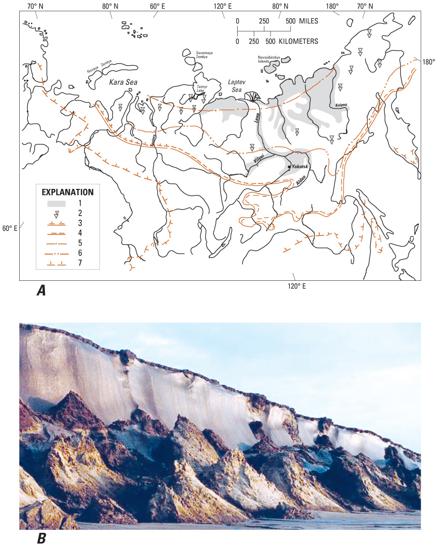 Figure 13.—A, Schematic map of the Edoma “Ice Complex” in northern Siberia. (1) Areas of extensive occurrences of the ice complex across a range of landforms; (2) areas of the ice complex occurring only in river valleys and lake depressions; 3–5 southern boundaries of regions of contemporary ice wedge development: in (3) peat deposits; (4) silt and clay deposits; (5) sand and gravel deposits; (6) southern boundary of the regions of low-centered polygons; (7) southern boundary of permafrost (N.N. Romanovskii, 1993). B, Exposure of eroding Edoma deposit along the Laptev Sea coast, northern Siberia, Russia (photograph by Volker Rachold). |

![]() U.S. Department of the Interior |
U.S. Geological Survey
U.S. Department of the Interior |
U.S. Geological Survey
URL: http://pubsdata.usgs.gov/pubs/pp/p1386a/gallery5-fig13.html
Page Contact Information: GS Pubs Web Contact
Page Last Modified: Thursday, 01-Dec-2016 16:26:04 EST
