Professional Paper 1386–A
Gallery contains 5 columns, so you may need to scroll to the right to see all images.
pp1386a5-fig01 |
pp1386a5-fig02 |
pp1386a5-fig03 |
pp1386a5-fig04a |
pp1386a5-fig04b |
pp1386a5-fig05 |
pp1386a5-fig06 |
pp1386a5-fig07 |
pp1386a5-fig08 |
pp1386a5-fig09 |
pp1386a5-fig10 |
pp1386a5-fig11a |
pp1386a5-fig11b |
pp1386a5-fig12 |
pp1386a5-fig13 |
pp1386a5-fig14 |
pp1386a5-fig15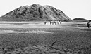 |
pp1386a5-fig16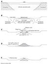 |
pp1386a5-fig17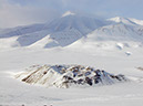 |
pp1386a5-fig18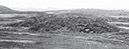 |
pp1386a5-fig19 |
pp1386a5-fig20 |
pp1386a5-fig21 |
pp1386a5-fig22 |
pp1386a5-fig23 |
| Back to top | ||||
pp1386a5-fig24 |
pp1386a5-fig25 |
pp1386a5-fig26 |
pp1386a5-fig27 |
pp1386a5-fig28 |
pp1386a5-fig29 |
pp1386a5-fig30 |
pp1386a5-fig31 |
pp1386a5-fig32 |
pp1386a5-fig33 |
pp1386a5-fig34 |
pp1386a5-fig35 |
pp1386a5-fig36 |
pp1386a5-fig37 |
pp1386a5-fig38 |
pp1386a5-fig39 |
pp1386a5-fig40 |
pp1386a5-fig41 |
pp1386a5-fig42 |
pp1386a5-fig43 |
pp1386a5-fig44 |
pp1386a5-fig45 |
pp1386a5-fig46 |
pp1386a5-fig47 |
pp1386a5-fig48 |
pp1386a5-fig49 |
pp1386a5-fig50 |
Back to top | ||

![]() U.S. Department of the Interior |
U.S. Geological Survey
U.S. Department of the Interior |
U.S. Geological Survey
URL: http://pubsdata.usgs.gov/pubs/pp/p1386a/gallery-5.html
Page Contact Information: GS Pubs Web Contact
Page Last Modified: Thursday, 01-Dec-2016 16:25:51 EST
