USGS Home

The Effects of the Chesapeake Bay Impact Crater on the Geological Framework and Correlation of Hydrogeologic Units of the Lower York-James Peninsula, Virginia

Plates 1-7

The plates range in size from 24 x 21 inches to 34 x 40 inches. For each plate below, an image file and a PDF file are provided. The image files are from 500 to 900 kilobytes, and the PDF files, which print at page size but can be blown up to 800 percent of size on screen, are 1 MB or smaller.

The Eastern Publications Group gratefully acknowledges the work of Ed Moser for producing these plate images and PDF files.


Plate 1. Location of Boreholes, Seismic Reflection Profiles, Stratigraphic Cross Sections GIF | PDF


Plate 2. Seismic Profile of Chesapeake Bay Impact Crater's Inner Basin GIF | PDF


Plate 3. Seismic Profiles from York River and Chesapeake Bay JPG | PDF


Plate 4. Lithostratigraphic Cross Section: Jamestown to Fort Monroe to Rescue, Virginia JPG | PDF


Plate 5. Stratigraphic Columns of Four Continuous Coreholes JPG | PDF


Plate 6A. Structure Contours of the Base of the Exmore Tsunami-Breccia Deposits GIF | PDF


Plate 6B. Isopach Contours of the Exmore Tsunami-Breccia Deposits GIF | PDF


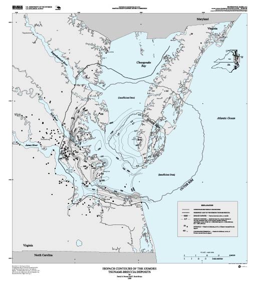
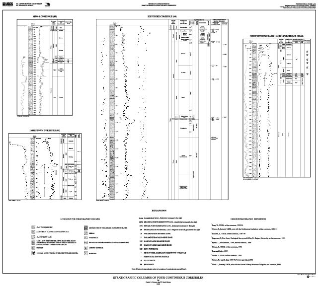
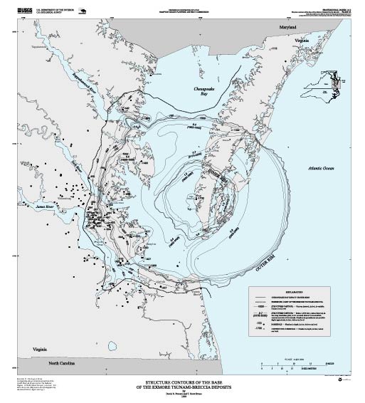
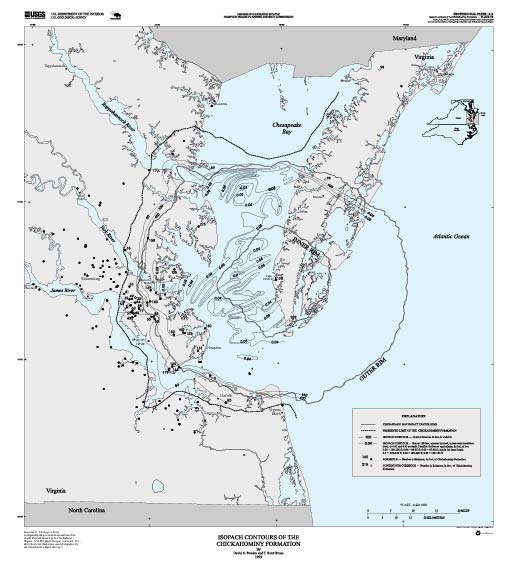
Plate 7A. Structure Contours of the Base of the Chickahominy Formation GIF | PDF


Plate 7B. Isopach Contours of the Chickahominy Formation GIF | PDF

Contents


U.S. Geological Survey, U.S. Department of the Interior
This page is https://pubs.usgs.gov/prof/p1612/plates.html
Maintained by the Eastern Publications Group; Contact: Dave Powars
Last modified 02.18.00