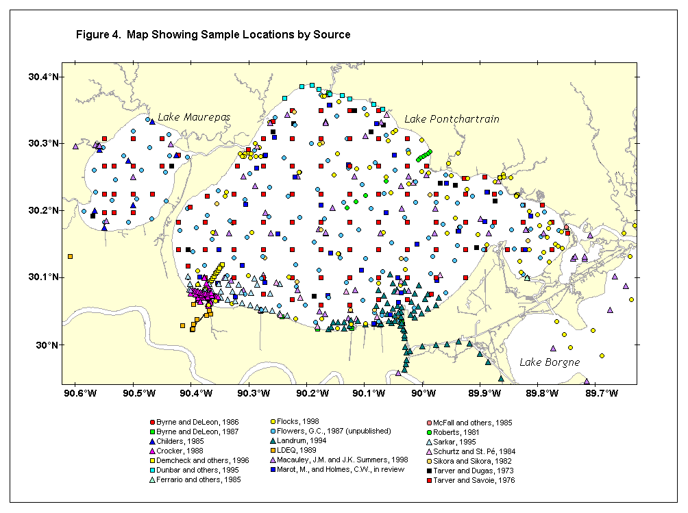
Grab samples are arbitrary collections of surficial sediments gathered by a clam-shaped apparatus that can be dropped from a boat to the bottom and recovered using a line. Grab sampling can be used to cover a large area with many samples in a short amount of time with relative ease. Usually the top 10 cm are collected during the process, and stratigraphic integrity is not maintained, so analysis is usually restricted to bulk characteristics. The sediment database developed during this study includes grab samples collected through various efforts from 1973 to the present (fig. 16) (Manheim and Hayes, this volume, fig. 4). Most surveys focused on specific areas of interest. For example, Landrum (1994) focused on the area around the Inner Harbor Navigational Canal and Lakefront Airport. Some surveys, however, were well distributed across the lake. In 1987, Flowers (Flowers and Isphording, 1990) collected over 100 samples throughout Lakes Pontchartrain and Maurepas for trace-metal and grain-size analysis, as did Tarver and Savoie (1976) (grain-size analysis). In 1995, the Environmental Protection Agency compiled an extensive collection of surficial samples from throughout the Pontchartrain Basin that were analyzed for organic and trace metal constituents. Analysis of the grab samples provides physical and chemical characterization of surficial sediments in the basin, such as lithology, grain size, and trace-metal distribution. Certain physical parameters such as lithology can be compared between studies to define temporal change. With proper data validation, certain geochemical analyses, such as trace-metal distribution, can also be compared.
|
|||||||||||||||