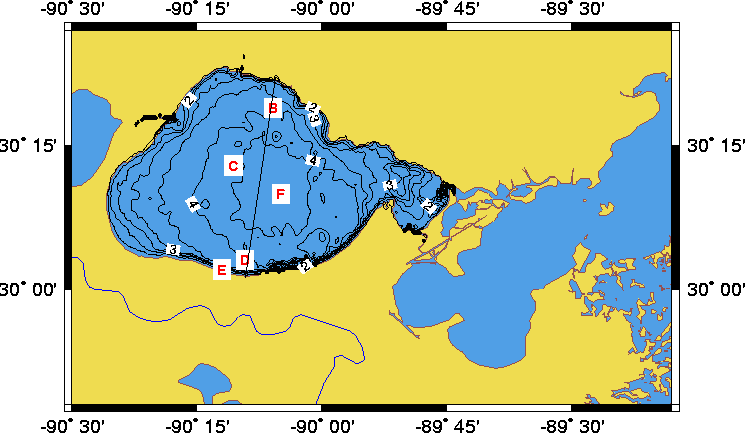
Figure 1. Locations of time series measurements collected during March-June 1995 (B, C, E) and January-May, 1998 (E and F). Each of these stations measured surface waves, beam attenuation, temperature and salinity at two vertical levels. The moorings in 1998 also measured currents. Depth of selected contours is shown in meters.
|