| Lake
Pontchartrain Basin: Bottom Sediments and Related Environmental
Resources |
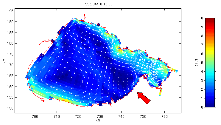
Figure 5. Simulated circulation on April 10, 1995, during a southeasterly wind event
of approximately 5 m/s. Arrow length and color indicates current magnitude. A two-gyre
wind response is indicated, where the flow current is downwind in the shallow regions of
the lake (mostly around the periphery) and against the wind in the deeper central region
of the lake. Although the model is three-dimensional, the depth-averaged currents are shown to indicate
overall water movement. There is also an animation
of the simulated 1995 currents. The movie is in the FLC format, which is
viewable with QuickTime 3.0 or
higher
(among other viewers).
 Back to Wind-Driven Circulation
|