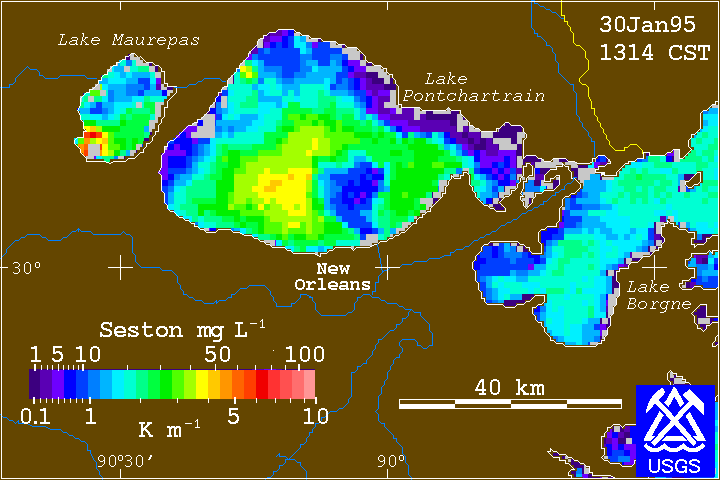
Figure 6. Remotely sensed image of inferred turbidity on January 30, 1995. On this date, relatively clear water is seen in the vicinity of the inner harbor navigation channel. This is an example of the more than 700 images that are being used to assess the spatial and temporal turbidity patterns in the lake and their relationship to wind and wave events.
|