GIS Project Files and WorkspacesArcExplorer project files, ArcView project files, and MapInfo workspaces are available to demonstrate the intended display parameters for most of the GIS layers. The CD-ROM is organized with the layers in the correct directories so that these project files can reference them. Additional layers can be added to these projects by opening them directly from the CD (from the directory sed_data/MapInfo/Tabs or sed_data/ArcView) or downloading the compressed versions first to the hard drive and decompressing them (see the data matrix).
The free GIS ArcExplorer version 1.1 software is provided so that any user with Windows 95/98 or NT can download it and use it to display the project files below (*.aep) or individual ArcView shapefiles (*.shp). The basic functions of the program are easy to learn. A manual for ArcExplorer version 1.1 is also provided in PDF format (requires Acrobat Reader software). The latest versions of the ArcExplorer and Adobe Acrobat software are available for free on the Internet; visit the web sites listed in Resource Links. Click here to install ArcExplorer from the CD (version 1.1). If you have trouble installing it from this link, go directly to the directory install/windows/ on your CD-ROM and double-click "aeclient.exe". Click here to open the ArcExplorer manual
from the CD (The manual, "arcexplorer.pdf", can also be opened
from the directory install/windows/).. Once you have installed ArcExplorer, the following project files may be opened
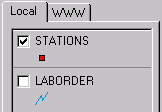
Note that the Class Breaks option in ArcExplorer uses quantile classification to create graduated color maps. In the quantile classification method, each class contains the same number of features. For this reason, the ranges of values chosen in the lead and zinc projects do not reflect the Effects-Range Low (ERL) and Effects-Range Medium (ERM) toxicity ranges (Long and others, 1995) as in MapInfo, ArcView, and .gif figures. Example of ArcExplorer project: Tips for getting started in ArcExplorer:
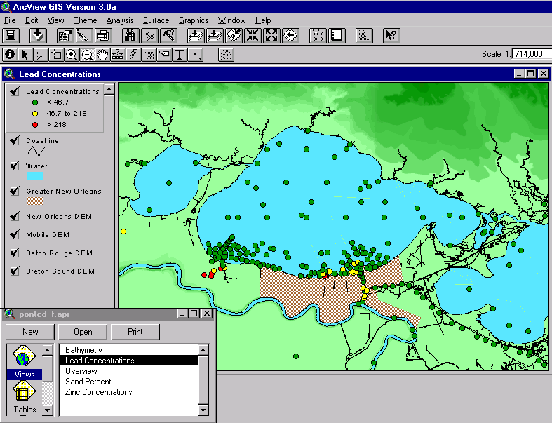
ArcView project files and MapInfo workspaces are offered here for users with either of these GIS software packages. They contain windows with some of the GIS layers displayed with appropriate colors and symbols to demonstrate the way they are intended to be viewed. These files provide a convenient introduction to the data. Other GIS layers may be added to these views or opened separately. Note that these files refer to files on the CD-ROM. If the .zip files containing GIS layers are saved to a hard drive, these project files and workspaces may have to be edited in order to reference that set of files correctly. This ArcView project file has relative path names, so it should open from any CD drive. It contains five views that correspond to the five separate project files for ArcExplorer and MapInfo (Overview, Bathymetry, Lead Concentrations, Zinc Concentrations, and Sand Percent).
Example of ArcView project:
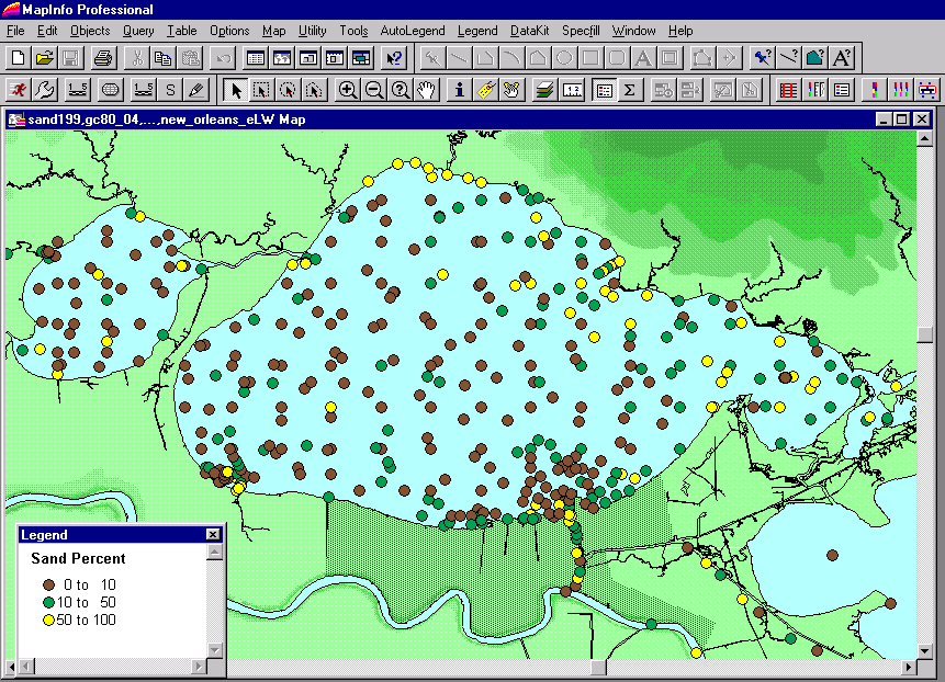
There are five MapInfo workspaces showing different layers. The pathnames are relative, so they should work with any drive letter.
Example of MapInfo workspace:
|
|||||||||||||||||||||||||||||||||||||||||||||||||||||||