 |
|
|
||||
| Professional Paper 1643: FIGURE 30 |
| About USGS / Science Topics / Maps, Products & Publications / Education / FAQ |
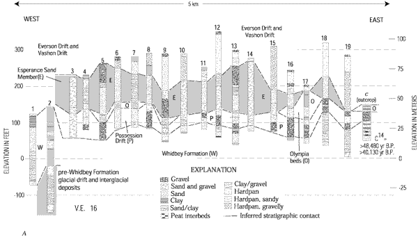
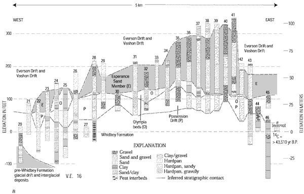
Interpretive east-west stratigraphic correlation diagrams north (A) and south (B) of the Devils Mountain fault. Information is from outcrops (figure 27, lettered sections) and lithologic logs from water wells (figure 28 and table 1, numbered sections), northern Whidbey Island.
Use BACK button to return
| AccessibilityFOIAPrivacyPolicies and Notices | |
| |
|