 |
| Professional Paper 1643: FIGURE 27 |
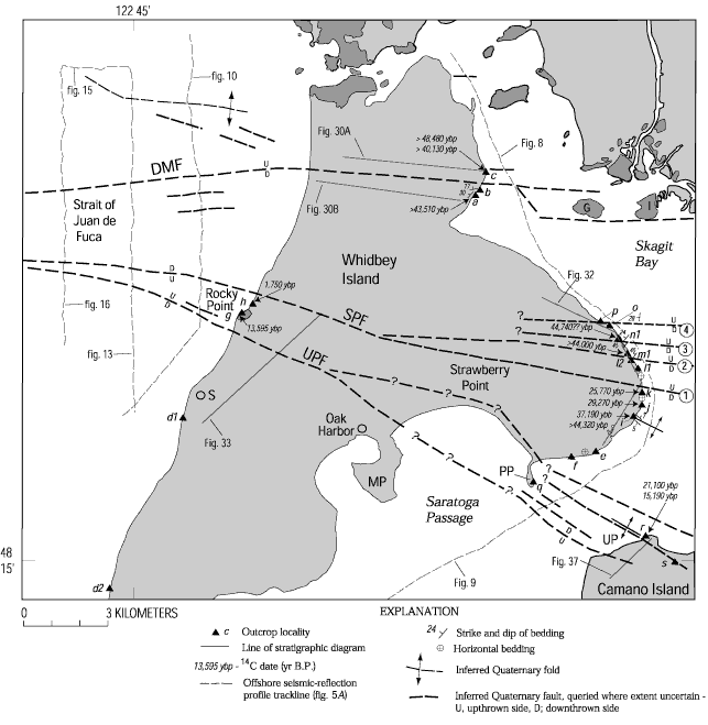
Figure 27
Northern Whidbey Island area showing locations of key outcrop localities described in text (designated by letters and triangles), radiocarbon dates ( table 2), nearby seismic-reflections profiles (plate 1), and faults and folds that deform Quaternary deposits. All dates are described in table 2 except the one obtained at g, which is described in Pessl and others (1989). Stratigraphic data from many outcrops were used in constructing stratigraphic correlation diagrams (figs. 30, 32, 33, 37). Circled numbers refer to faults that cut Strawberry Point, as described in text. Dark-shaded areas are underlain by pre-Quaternary bedrock; light-shaded areas are underlain by Quaternary deposits. DMF, Devils Mountain fault; G, Goat Island; I, Ika Island; MP, Maylor Point; PP, Polnell Point; S, Swantown; SPF, Strawberry Point fault; UP, Utsalady Point; UPF, Utsalady Point fault.
Use BACK button to return
Contact: Susan Rhea
This page is brought to you by the Earthquake Hazards Program
